
Hatcher Pass
|
|
This information is a Conditions Update. Danger ratings are only issued with avalanches advisories. The next avalanche advisory is scheduled for Saturday February 16, 2019.
Previous avalanche advisories HERE
MIDWEEK SNOW AND AVALANCHE CONDITIONS SUMMARY
Avalanche hazard exists for persistent slab at mid to upper elevations. Human triggered avalanches are possible and natural avalanches are unlikely. Remotely triggered avalanches will be possible in isolated areas. The last natural and human triggered avalanches occurred last week.
Slab avalanches are the main concern, 0.5-3.5 feet deep, and large enough to bury, injure, or kill a person.
At low elevations, natural and human triggered avalanches are unlikely.
Avoid steep slopes with terrain traps such as gullies or cliffs, and choose slopes with gentle, fanning run-outs.
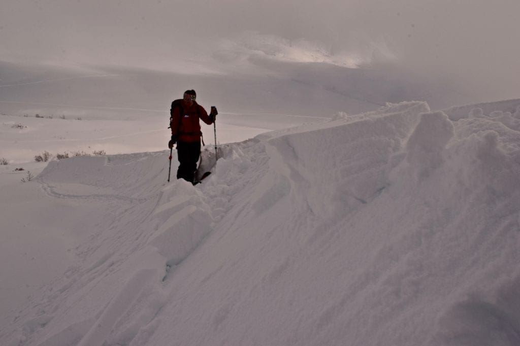
Monday night a storm brought 2″ of new snow (0.16″ SWE). Winds increased Tuesday, filling in old tracks and leaving the snow surface wind affected. A drizzle crust is still quite noticeable across Hatcher Pass and seems thicker near Hatch Peak and Skyscraper, versus thinner and barely discernible near Government Peak. Good ski quality has been found in areas with a thinner drizzle crust and at lower and mid elevations.
This report is a mid-week conditions update, so please be sure to check hpavalanche.org for advisories on Saturdays and follow the HPAC Facebook for updates. Help us keep tabs on the Hatcher Pass area! If you see any avalanche activity send us an observation HERE. Thank you to everyone who has already submitted observations this season – you can see those HERE!
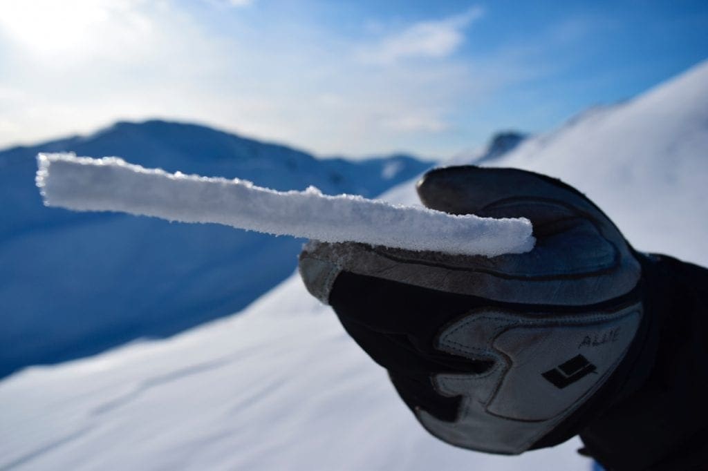
A drizzle crust affecting ski quality can be found in most areas of Hatcher Pass.

Moderate to strong winds 2/12 transported the 2″ of new snow and some older snow in areas where the drizzle crust was patchy. The snow surface is now slightly wind affected with surfaces ranging from drizzle crust, to soft sastrugi, to packed powder.

The drizzle crust affecting ski quality varies in thickness across Hatcher Pass. Areas like Government Peak have a barely discernable drizzle crust at upper elevations.
| |
|
|
|
|
|
| Travel Advice | Generally safe avalanche conditions. Watch for unstable snow on isolated terrain features. | Heightened avalanche conditions on specific terrain features. Evaluate snow and terrain carefully; identify features of concern. | Dangerous avalanche conditions. Careful snowpack evaluation, cautious route-finding, and conservative decision-making essential. | Very dangerous avalanche conditions. Travel in avalanche terrain not recommended. | Extraordinarily dangerous avalanche conditions. Avoid all avalanche terrain. |
| Likelihood of Avalanches | Natural and human-triggered avalanches unlikely. | Natural avalanches unlikely; human-triggered avalanches possible. | Natural avalanches possible; human-triggered avalanches likely. | Natural avalanches likely; human-triggered avalanches very likely. | Natural and human-triggered avalanches certain. |
| Avalanche Size and Distribution | Small avalanches in isolated areas or extreme terrain. | Small avalanches in specific areas; or large avalanches in isolated areas. | Small avalanches in many areas; or large avalanches in specific areas; or very large avalanches in isolated areas. | Large avalanches in many areas; or very large avalanches in specific areas. | Very large avalanches in many areas. |
Above 2500′ on slopes steeper than 35°, it will be possible to trigger slab avalanches 0.5-3.5 feet deep on several persistent weak layers. These weak layers include last week´s drizzle crust, isolated buried surface hoar in the upper snowpack, facets in the mid pack, and facets near the ground.
The last human triggered avalanche was 2/6, when a snowmachiner remote triggered a large avalanche on a north aspect near Idaho peak. The last natural avalanche was observed 2/5 on a northwest aspect of Marmot mountain.
Shooting cracks, whumphing, or collapsing may or may not be present prior to triggering this avalanche problem.

Observers have found poor snowpack structure and propagation potential in the mid elevations.
Observers were able to trigger very small wind slabs 6-12″ deep failing on top of the drizzle crust on Lower Eldorado Bowl NNE test slopes on 2/12
Weather History
Weather at 3450′ since Saturday 2/9:
Temperatures averaged 22°F, with a low of 2°F and a high of 34°F.
Winds averaged NW 5 mph, max 15 mph. Max gusts recorded were 34 mph NW Tuesday night.
There has been ~2″ of snow (0.16″ SWE) recorded at Independence Mine since Saturday 2/9.
Weather at 4500′ since Saturday 2/9:
Temperatures averaged 18°F, with a low of 2°F and a high of 30°F.
Winds averaged SE 4 mph, max 12 mph. Gusts averaged SE 10 mph, max gust 27 mph*.
*Note*: Moderate to strong north to northwest winds occurred Tuesday afternoon through Wednesday morning. Marmot weather station typically under reports for this wind direction.
Forecast Weather
Stay tuned to the NOAA point forecast for an updated weather forecast each day. The best way to see if it’s snowing in Hatcher Pass is to look at the webcam snow stake HERE and the Independence Mine SNOTEL site HERE
State Parks Snow Report and Motorized Access information can be found here.


