Hatcher Pass
|
 Archives
|
 The Bottom Line
Persistent slab avalanches and wind slab avalanches will be possible to human-trigger in specific locations.
We will be headed to safer terrain choices including lower angle slopes 25º and less and out of the runout of steeper slopes from above.
We currently have shallow coverage with only 6-20″ of total snowpack.
It’s early in the season and we are still getting a handle on the snowpack and conditions. We have not been able to get to the uppermost elevations for assessment.
 Special Announcements
WELCOME to the 2022/2023 season!
Don’t forget to click on the weather and observation tabs for more info!
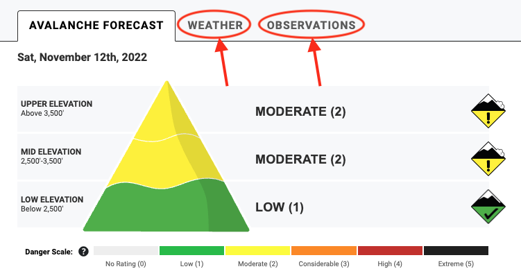
Use the menu buttons to find out more about HPAC and navigate our site as well as DONATE today by clicking on the big red button!



| |
|
 |
 |
 |
|
| Travel Advice | Generally safe avalanche conditions. Watch for unstable snow on isolated terrain features. | Heightened avalanche conditions on specific terrain features. Evaluate snow and terrain carefully; identify features of concern. | Dangerous avalanche conditions. Careful snowpack evaluation, cautious route-finding, and conservative decision-making essential. | Very dangerous avalanche conditions. Travel in avalanche terrain not recommended. | Extraordinarily dangerous avalanche conditions. Avoid all avalanche terrain. |
| Likelihood of Avalanches | Natural and human-triggered avalanches unlikely. | Natural avalanches unlikely; human-triggered avalanches possible. | Natural avalanches possible; human-triggered avalanches likely. | Natural avalanches likely; human-triggered avalanches very likely. | Natural and human-triggered avalanches certain. |
| Avalanche Size and Distribution | Small avalanches in isolated areas or extreme terrain. | Small avalanches in specific areas; or large avalanches in isolated areas. | Small avalanches in many areas; or large avalanches in specific areas; or very large avalanches in isolated areas. | Large avalanches in many areas; or very large avalanches in specific areas. | Very large avalanches in many areas. |
11/11 Yesterday – Human triggered persistent slab avalanche on Marmot SW face. First skier triggered. No one was caught. This party reported whumphing and shooting cracks during their tour. See observation here.
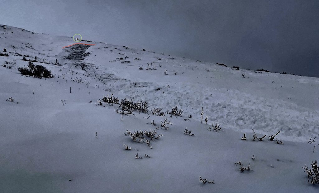
11/11 – Human triggered persistent slab avalanche on SW face Marmot, est. 3800′
Numerous small natural and human-triggered persistent slab avalanches failed during and just after the 11/7-8 storm which brought 10″ of new low-density snow at 3000′ :
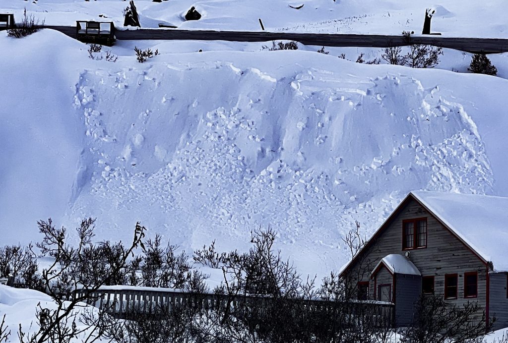
Observed 11/9, likely failed during or just after storm. Independence Mine Area, SE, 3600′. Bed surface here was at the interface between the newer snow (11/7-8) and the thick sugary layer near the ground.
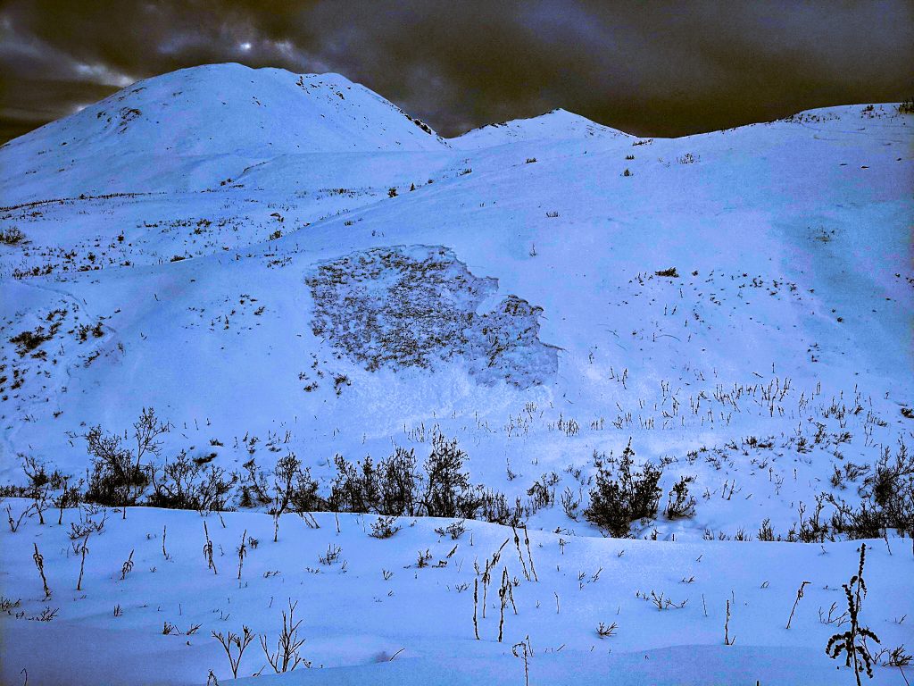
11/8 – Fishhook Creek sidewall Remotely triggered. East, 3000′. Bed surface was both raw ground and a patchy ice crust at the ground.
| Signal Word | Size (D scale) | Simple Descriptor |
| Small | 1 | Unlikely to bury a person |
| Large | 2 | Can bury a person |
| Very Large | 3 | Can destroy a house |
| Historic | 4 & 5 | Can destroy part or all of a village |
The current setup will allow for small to large human-triggered avalanches on all aspects and on slopes 30° and steeper. Problem areas may allow you to ski a slope more than once before triggering it.
Unfortunately, the more likely locations for triggering this problem are where there is more snow and better coverage at the mid to upper elevations. There is not much snow at lower elevations so we don’t expect to see this problem there today.
Persistent slabs, generally 6-10” thick, but in some cases up to 18″ thick, will be possible to human trigger at mid and upper elevations, on all aspects, above 2500’. In some cases where slabs have failed at the ground, slab depth is up to 20″ (see Fishhook Creek sidewall example above).
10″ of new snow accumulated on 11/7-8 at IM Snotel which rapidly overloaded a weak faceted snow layer resulting in natural avalanche activity. Since then the snowpack has adjusted a bit and stability has increased. However, this kind of poor structure is still suspect, this weak layer will persist for a long time, and triggering a slab avalanche is still possible.
The newer snow is low-density and just barely cohesive enough to act as a slab. The deeper sugar snow is very weak. Shooting cracks, whumping, and recent avalanches are all bulls-eye clues for the avalanche problem.
To avoid this problem stick to terrain that is 25º or less and out of the runout of steeper slopes from above.
New loading will overload our weak snowpack and increase the avalanche hazard and activate the weak layer. NOAA is forecasting some minimal snow today which should not impact the avalanche problem today. However, snow accumulation from late in the day through tomorrow morning may bring 4-6″ of snow for Sunday. Expect the avalanche hazard to increase if we get more than 4″ of snow by tomorrow.
Video: Above Independence Mine, East, 3800′
| Signal Word | Size (D scale) | Simple Descriptor |
| Small | 1 | Unlikely to bury a person |
| Large | 2 | Can bury a person |
| Very Large | 3 | Can destroy a house |
| Historic | 4 & 5 | Can destroy part or all of a village |
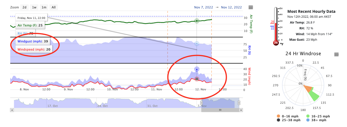
Southeast wind speeds picked up yesterday afternoon and overnight transporting available snow to West to North aspects at upper elevations. Gusts at the Marmot Weather Station (4500′) reached into the 30’s mph with a max gust of 39 mph at 10 pm last night.
Wind slabs are sitting on a widespread weak sugary faceted snow layer and will be possible to human trigger.
Shooting cracks and whumphing are red flags for this avalanche problem.