
Hatcher Pass
|
|
This is not an Avalanche Advisory. This information is a Conditions Update. The next avalanche advisory is scheduled for Saturday January 5, 2019.
Previous avalanche advisories HERE
MIDWEEK SNOW AND AVALANCHE CONDITIONS SUMMARY
BOTTOM LINE: A series of strong storms brought 17″ of snow, strong SE ridge top winds, and moderate valley bottom winds since Friday 12/27. Another round of dangerous avalanches conditions is expected, as our thin, weak snowpack has been overloaded once again. Careful snowpack evaluation, cautious route-finding, and conservative decision making will be essential if you venture into the mountains of Hatcher Pass today. Natural avalanches are possible and human-triggered avalanches are likely at upper elevations (>3000 ft) on wind-loaded slopes.
The wind has stripped windward SE aspects and built slabs on leeward Northerly and Westerly aspects. The last human-triggered and natural avalanches were reported Monday, 12/30/2018, during a strong wind event. The 10″ of new low density snow that accumulated yesterday, 1/2/2019, has blanketed and covered up previous surface clues, making it more challenging to identify the loaded aspects where triggering an avalanche will be more likely. Rocks and hazards will also be barely concealed in areas with a thinner snowpack.
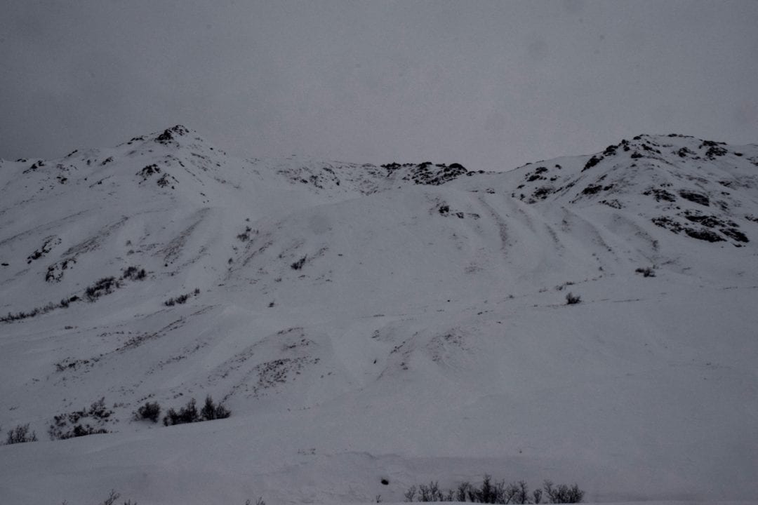
10″ of new snow now blankets the wind ravaged landscape.
This report is a mid-week conditions update, so please be sure to check hpavalanche.org for advisories on Saturdays and follow the HPAC Facebook for updates. Help us keep tabs on the Hatcher Pass area! If you see any avalanche activity send us an observation HERE. Thank you to everyone who has already submitted observations this season – you can see those HERE!


| |
|
|
|
|
|
| Travel Advice | Generally safe avalanche conditions. Watch for unstable snow on isolated terrain features. | Heightened avalanche conditions on specific terrain features. Evaluate snow and terrain carefully; identify features of concern. | Dangerous avalanche conditions. Careful snowpack evaluation, cautious route-finding, and conservative decision-making essential. | Very dangerous avalanche conditions. Travel in avalanche terrain not recommended. | Extraordinarily dangerous avalanche conditions. Avoid all avalanche terrain. |
| Likelihood of Avalanches | Natural and human-triggered avalanches unlikely. | Natural avalanches unlikely; human-triggered avalanches possible. | Natural avalanches possible; human-triggered avalanches likely. | Natural avalanches likely; human-triggered avalanches very likely. | Natural and human-triggered avalanches certain. |
| Avalanche Size and Distribution | Small avalanches in isolated areas or extreme terrain. | Small avalanches in specific areas; or large avalanches in isolated areas. | Small avalanches in many areas; or large avalanches in specific areas; or very large avalanches in isolated areas. | Large avalanches in many areas; or very large avalanches in specific areas. | Very large avalanches in many areas. |
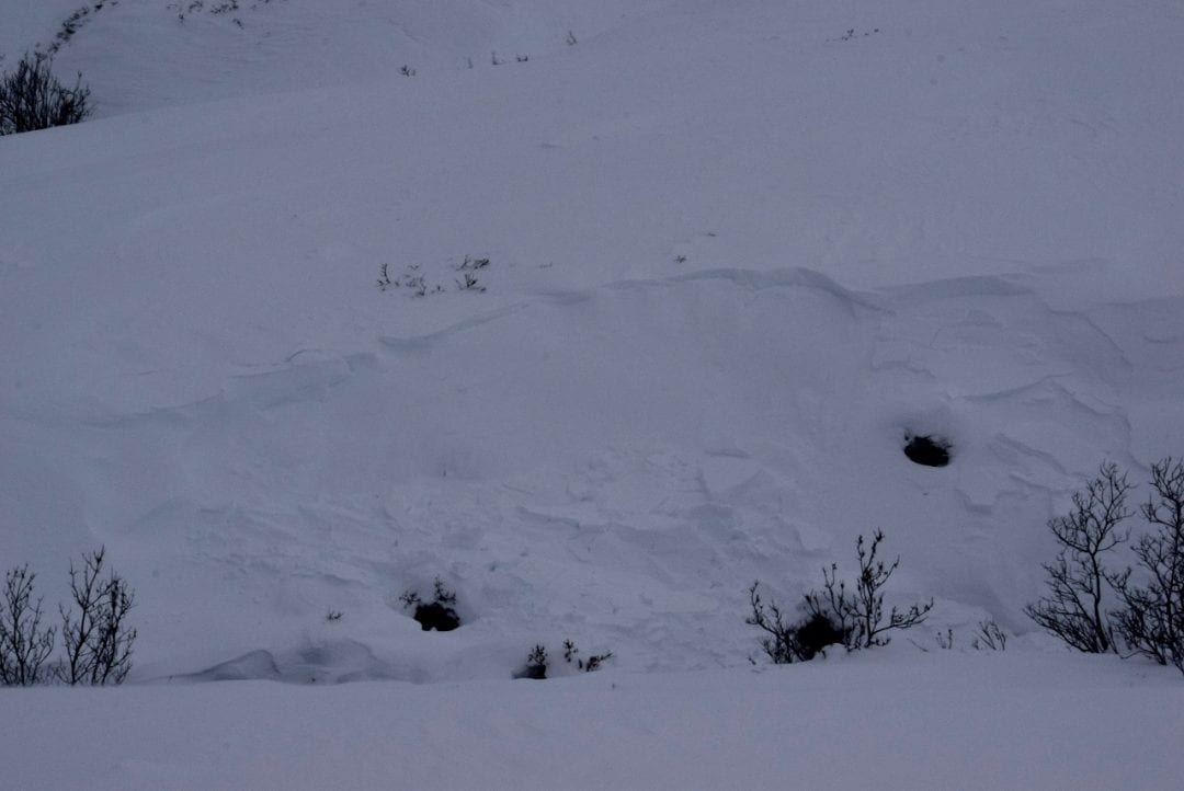
Sunday December 30th during a storm event there were several human triggered and natural avalanches including:
Natural D2 (large) persistent slab avalanche on a North aspect in Upper Eldorado Bowl.
Natural D1 (small) wind slab avalanche on an East aspect in Lower Eldorado Bowl.
Natural D2 (large) slab avalanche in Martin Mine Gully.
Above: Human-triggered D1 (small) wind slab avalanche on an East aspect near the Independence Mine nordic ski trail.
Human-triggered D1 (small) wind slab avalanche on an East aspect on Eldorado moraine.
Human-triggered D1 (small) slab avalanche on Cross Hill.
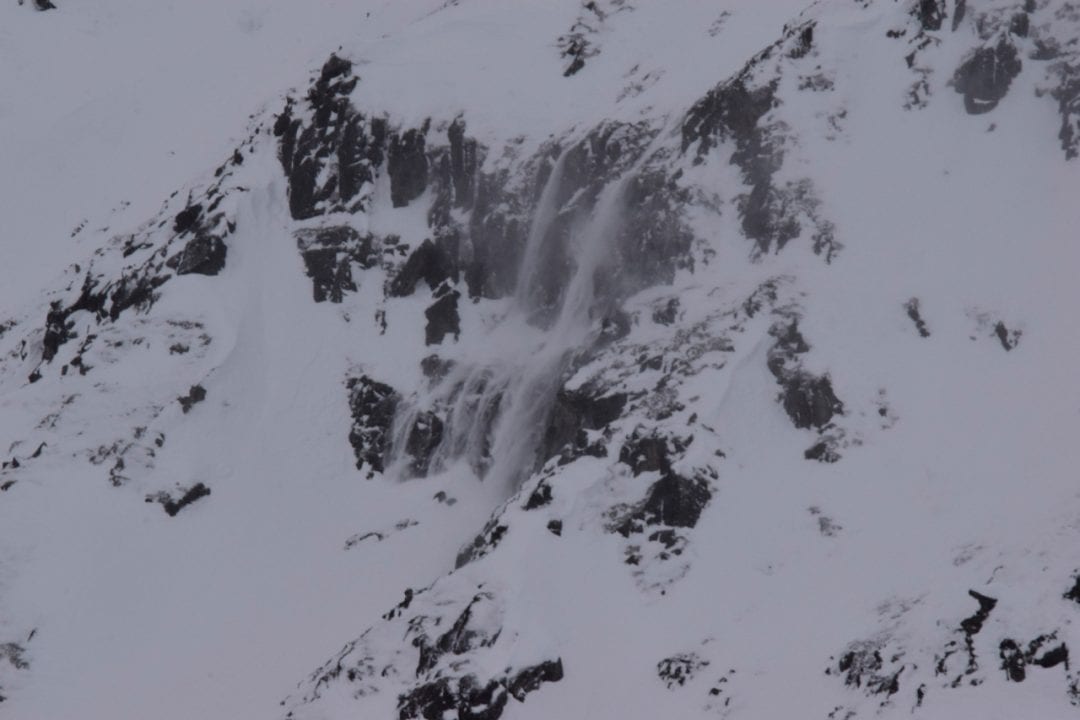
Above: constant dry loose avalanching/spindrift off of Skyscraper.
Above: Natural small (D1) wind slab on E aspect of Fishhook Creek sidewall.
You can see observations related to these avalanches here.
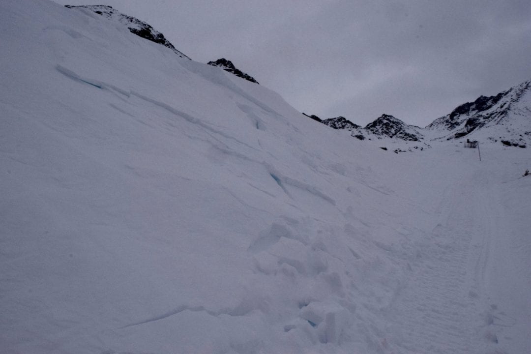
New snow and strong winds have added stress to a thin snowpack riddled with persistent weak layers. While this avalanche problem is present on all aspects, it is most likely to be triggered above 3000′, on leeward Northerly and Westerly aspects, on slopes 35º and steeper. Slabs may be 1-5 ft deep.
Spotting the most likely places to trigger this avalanche problem will be challenging as around 10″ of new snow has fallen under calm to light winds, perfectly obscuring stripped and loaded locations. There may be no warning signs like whumphing, collapsing, or shooting cracks before triggering an avalanche.
It will be wise to give the snowpack time to adjust to this new load before venturing into steeper terrain. Avoid slopes with terrain traps such as gullies, ravines, cliffs, and abrupt changes from steep to flat that could amplify the consequences of even a small slide. We can decrease the consequences of an avalanche by choosing slopes with gentle, fanning run-outs and expose only one person at a time to the possible hazard.
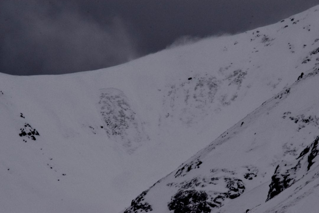
Above: Strong winds and new snow have overloaded persistent weak layers causing large D2 avalanches such as this one reported 12/30 in Eldorado Bowl on a N aspect.
Wind slabs 1-2 ft deep may be found above 3000 ft on leeward Northerly and Westerly aspects and in cross-loaded gullies and channeled terrain. Triggering a wind slab will be most likely on slopes 35º and steeper. Give these wind slabs a few days to heal and know that triggering a wind slab could result in an avalanche stepping down into deeper persistent weak layers.
Feel for wind slabs by pole probing for stiff, hard, and hollow sounding snow. Be aware that wind slabs have a tendency to allow you to venture out onto them and then break above you.
With 10″ of yesterday’s low density new snow, triggering a storm snow or loose dry avalanche will be most likely on slopes 40º and steeper, above 3000 ft. While these avalanches may not be large enough to bury you, they may knock you off of your feet in steep terrain, carry you in to terrain traps such as rocks and cliffs, or possibly bury you if caught in a terrain trap such as a creek, ravine, gully or depression.
Weather History
13″ of new light density snow (1.03″ SWE) has fallen since the morning of Saturday 12/29, and much of this snow has been accompanied by strong SE winds. Nearly 2″ of snow (0.1″ SWE) fell Saturday 12/29, 0.14″ SWE fell during strong winds Sunday 12/30, 1.5″ of snow (4 cm SWE) fell Monday 12/31, and 10″ of snow (0.61″ SWE) fell Wednesday 1/2.
Wind speeds were 20-40 mph, gusting 30-50 mph at ridgetops Sunday 12/30-Tuesday 1/1. Valley bottoms winds increased from to 10-18 mph Sunday 12/30 – Tuesday 1/1. Ridgetop winds decreased to 5-10 mph with gusts up to 20 mph with the latest round of snowfall Wednesday 1/2.
Temperatures on ridgetops increased from single digits F Saturday 12/29 into the 20s F and low 30s F this week. In valley bottoms temperatures increased from teens F Saturday 12/29 to lower 30s F during the week.
Forecast Weather
Thursday there is a chance of isolated snow showers in the morning with trace accumulation. Winds are expected to be calm to light (up to 10 mph) at ridgetops out of the NE. Skies are forecast to be sunny Thursday and mostly sunny Friday. Temperatures are expected to be colder, with highs in the low teens and lows in the single digits.
Stay tuned to the NOAA point forecast for an updated weather forecast each day. The best way to see if it’s snowing in Hatcher Pass is to look at the webcam snow stake HERE and the Independence Mine SNOTEL site HERE


