
Hatcher Pass
|
|
Today a MODERATE avalanche hazard for persistent slab and loose dry avalanches exists. Human triggered avalanches are possible and natural avalanches are unlikely.
Slab avalanches are the main concern, up to 2-4 feet deep (consistent with the depth of the snowpack), and large enough to bury, injure, or kill a person.
We can not emphasize this enough, AVOID STEEP SLOPES WITH TERRAIN TRAPS; choose slopes with gentle, fanning runouts.
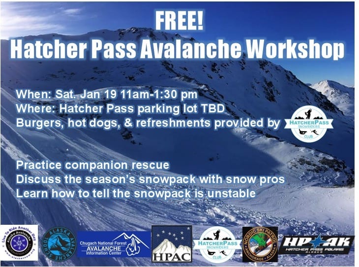
Mark your calendars for the annual Hatcher Pass Avalanche Workshop coming up on Saturday January 19th.
Save the date: HPAC Annual Fundraiser and Cabin Fever Reliever, Saturday,February 2, 2019 at the Moose Lodge in Palmer. Tickets available soon, stay tuned! Tell your friends!
| |
|
|
|
|
|
| Travel Advice | Generally safe avalanche conditions. Watch for unstable snow on isolated terrain features. | Heightened avalanche conditions on specific terrain features. Evaluate snow and terrain carefully; identify features of concern. | Dangerous avalanche conditions. Careful snowpack evaluation, cautious route-finding, and conservative decision-making essential. | Very dangerous avalanche conditions. Travel in avalanche terrain not recommended. | Extraordinarily dangerous avalanche conditions. Avoid all avalanche terrain. |
| Likelihood of Avalanches | Natural and human-triggered avalanches unlikely. | Natural avalanches unlikely; human-triggered avalanches possible. | Natural avalanches possible; human-triggered avalanches likely. | Natural avalanches likely; human-triggered avalanches very likely. | Natural and human-triggered avalanches certain. |
| Avalanche Size and Distribution | Small avalanches in isolated areas or extreme terrain. | Small avalanches in specific areas; or large avalanches in isolated areas. | Small avalanches in many areas; or large avalanches in specific areas; or very large avalanches in isolated areas. | Large avalanches in many areas; or very large avalanches in specific areas. | Very large avalanches in many areas. |
Remotely triggered, natural, and human triggered avalanches were reported on 12/30. These avalanches occurred as a result of high winds. See more information HERE.
No other avalanches have been reported.
A recent round of strong, Southeast winds earlier in the week, wind loaded leeward aspects, generally West to North, tipping the balance and resulting in some natural and human triggered avalanche activity. The snowpack has now adjusted to this new load. The last natural avalanche observed was around December 30-31, during the 12/30-1/2 wind event.
The good news is stability has generally been on the healing trend, albeit a very slow trend. The bad news is, weak layers in the snowpack will not be going away anytime soon, and will continue to be problematic.
Today human triggered slab avalanches will be possible at mid to upper elevations, on all aspects, up to 2-4 feet deep, on slopes 35º and steeper. Remotely triggered avalanches may be possible in isolated locations, more likely, but not limited to, upper elevations. Expect slab avalanches to be much deeper, and therefore more consequential, on previously wind loaded, leeward aspects and features, generally West to North.
A number of weak layers exist in the snowpack, but we are currently most concerned about two in particular.
Video below from January 4, 2019: Snowpit instability test results on the persistent slab problem Marmot Mountain, W, 3800′, 41º slope. Basal facets require a lot of force to trigger, but when they do propagation results are alarming.
[Pit in video shows results representative for the area: Moderate to strong strength, poor structure, and high propagation.]
Loose dry avalanches will generally be possible to trigger on all aspects, on slopes 35º and steeper, at mid to upper elevations. Approximately 8-10″ of low density snow is sitting on smooth, firm surfaces. Triggering a loose dry avalanche will be uneventful in most circumstances, however, it may be possible to be caught and carried by this avalanche problem into greater hazards such as terrain traps, which will compound the risk and make this hazard very real.
This week’s weather at 3550′:
Temps averaged 20ºF, with a low of 8ºF and a high of 34ºF.
IM reported 10″ of new snow.
Overnight at 3550′:
Temps averaged 13°F.
No new snow.
This week’s weather at 4500′:
Temps averaged 16ºF, with a low of 5ºF and a high of 26ºF.
Winds averaged SE 11 mph, max 43 mph . Gusts averaged SE 19 mph, max gust SE 56 mph.
Overnight at 4500′:
Temps averaged 12ºF overnight, with a Low of 9ºF.
Winds averaged SE 3 mph overnight. Max gust E 7 mph.
NWS Rec Forecast HERE
State Parks Snow Report and Motorized Access information HERE
TREND
HP’s weak snowpack will persist for a very long time. Pay attention to weather changes as our snowpack will not like rapid change. Each time our snowpack is rapidly loaded with new snow, or wind transported snow, expect the avalanche hazard to rise. Each time the weather becomes mild and boring, expect the snowpack’s stability to slowly increase.
This weekend the forecast is calling for light winds and cool temps. This kind of weather will not increase the avalanche hazard. However, pay close attention to the winds. For Sunday and into Monday, models are suggesting a slight increase in the pressure differential between mainland Alaska and the Southcentral coastline. This is not predicted to increase winds speeds over the next couple days. However, if the pressure differential were to build beyond the forecast, strong, outflow winds could increase in the avalanche hazard.
.


