
Hatcher Pass
|
|
This information is a Conditions Update. Danger ratings are only issued with avalanches advisories. The next avalanche advisory is scheduled for Saturday February 23, 2019.
Previous avalanche advisories HERE
MIDWEEK SNOW AND AVALANCHE CONDITIONS SUMMARY
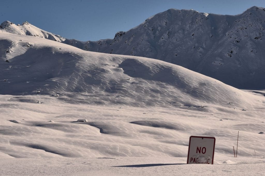
Avalanche hazard exists for persistent slab at all elevations. Careful snowpack evaluation, cautious route-finding and conservative decision-making are essential. Widespread natural avalanches occurred during the storm last weekend. The last reported human triggered avalanche was on Tuesday this week, when a snowmachiner remote triggered a large avalanche from the flats near Dogsled Pass. No one was caught.
Slab avalanches are the main concern, 2 feet deep at low elevations, and 3+ feet deep at mid to upper elevations. Avalanches could be large enough to bury, injure, or kill a person.
Avalanches may be remotely triggered from the flats below, or from adjacent or connected terrain, and may run long distances.
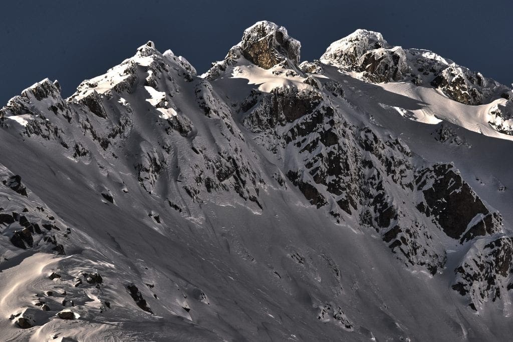
Storms starting last weekend have brought 35″ of low density new snow (2.5″ SWE) to Hatcher Pass. With plenty of seductive powder and fair weather on tap starting Friday, this is a perfect recipe for human triggered avalanches. Superb skiing and riding quality abounds, but there is limited information about how the snow will react to a trigger like a skier or snowmachine in steep terrain. At this time, it is best to approach the mountains with caution, and give the snowpack time to adjust to the new load.
Avoid steep slopes of any size with terrain traps such as gullies or cliffs, and choose slopes with gentle, fanning run-outs. It’s best to play on low angle terrain until the snowpack has time to adjust to the new load.
This report is a mid-week conditions update, so please be sure to check hpavalanche.org for advisories on Saturdays and follow the HPAC Facebook for updates. Help us keep tabs on the Hatcher Pass area! If you see any avalanche activity send us an observation HERE. Thank you to everyone who has already submitted observations this season – you can see those HERE!
35” of new snow have arrived this week for Hatcher Pass.

| |
|
|
|
|
|
| Travel Advice | Generally safe avalanche conditions. Watch for unstable snow on isolated terrain features. | Heightened avalanche conditions on specific terrain features. Evaluate snow and terrain carefully; identify features of concern. | Dangerous avalanche conditions. Careful snowpack evaluation, cautious route-finding, and conservative decision-making essential. | Very dangerous avalanche conditions. Travel in avalanche terrain not recommended. | Extraordinarily dangerous avalanche conditions. Avoid all avalanche terrain. |
| Likelihood of Avalanches | Natural and human-triggered avalanches unlikely. | Natural avalanches unlikely; human-triggered avalanches possible. | Natural avalanches possible; human-triggered avalanches likely. | Natural avalanches likely; human-triggered avalanches very likely. | Natural and human-triggered avalanches certain. |
| Avalanche Size and Distribution | Small avalanches in isolated areas or extreme terrain. | Small avalanches in specific areas; or large avalanches in isolated areas. | Small avalanches in many areas; or large avalanches in specific areas; or very large avalanches in isolated areas. | Large avalanches in many areas; or very large avalanches in specific areas. | Very large avalanches in many areas. |
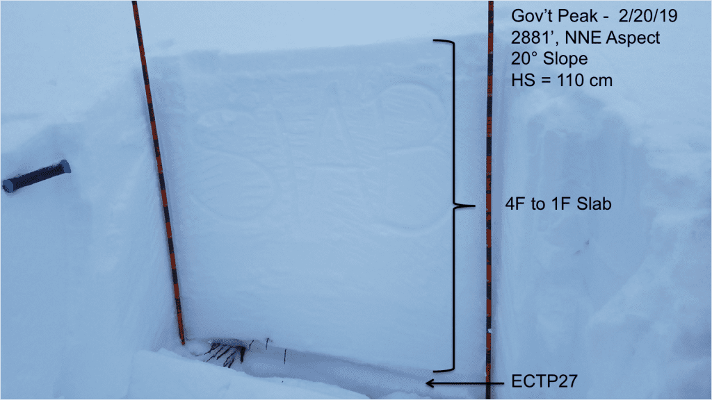
Numerous, widely propagating, natural slab avalanches occurring during or shortly after the 2/16-18 storm. Avalanches generally failed within storm snow, and wider and deeper, on the 2/5 CNY crust.
The last reported human triggered avalanche was last Friday 2/15
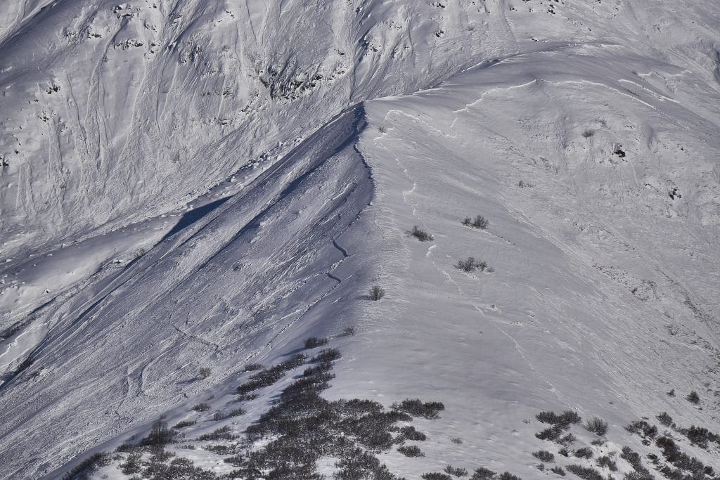
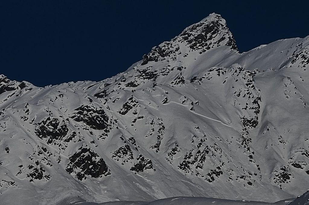
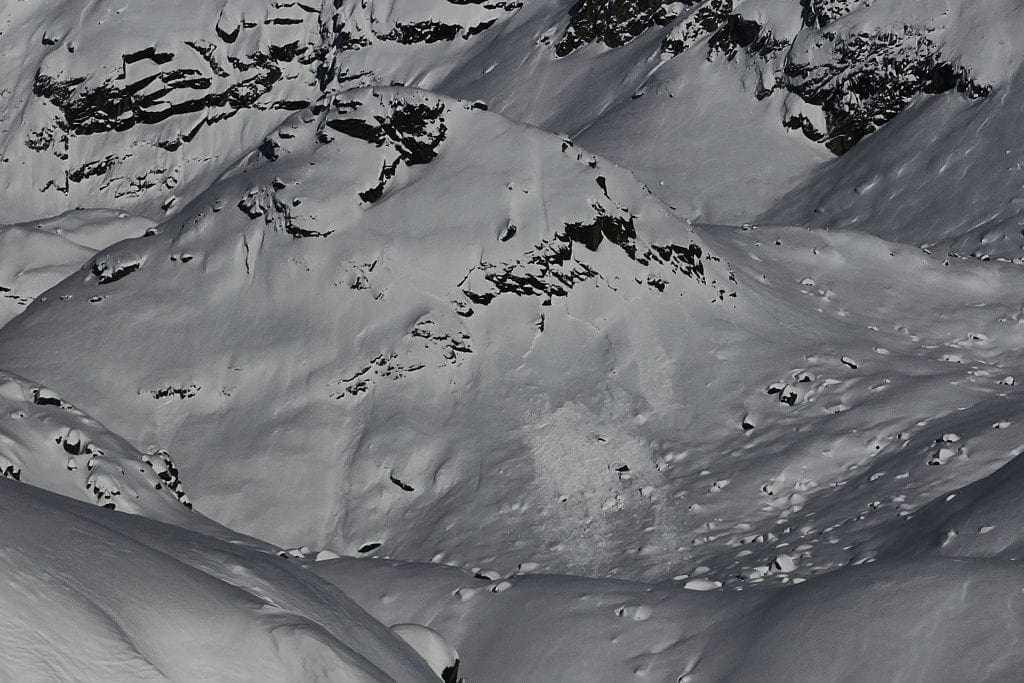
Above: Idaho Peak, Divide Ridge, S>NW, 2300-4000′, approx 1-2 feet deep, wide propagation, likely failing on buried surface hoar over CNY crust bed surface. Avalanche propagated around the ridge to the northern aspect, out of view in this photo.
Above: Same as previous picture, notice propagation up to skyline ridge and other avalanches to the right mid-slope.
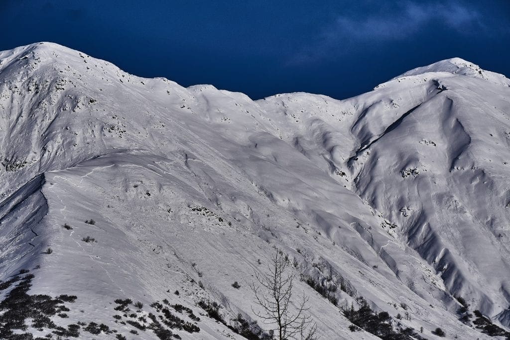
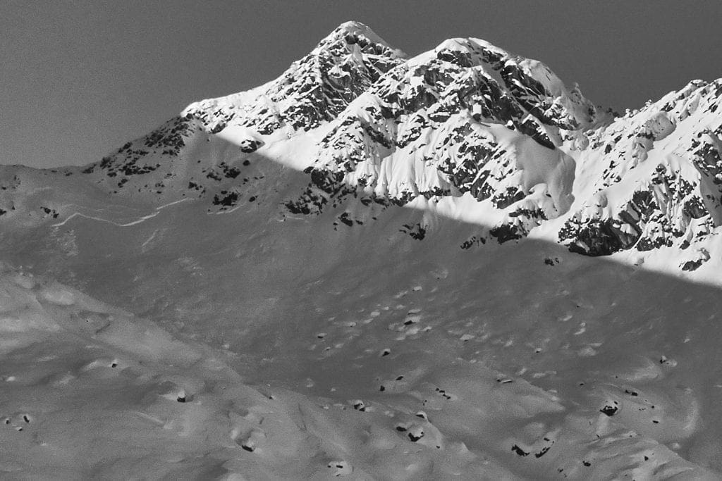
Above: Hatch Peak East Ridge, viewed from road. NE aspect, 3800′. Failed on CNY crust, 1-2 feet deep.
Above: Near Friendship Pass, E, 4800′. Wide propagation failing on CNY crust.
Above: Nose Hair Chutes, S, 4650′. Wide propagation failing on CNY crust, 1-2 feet deep.
Above: High Grade, E>SE, 4550′. Notice storm interface failure of thin crowns above the deeper failure on the CNY crust. The thinner storm snow failure may have stepped down, triggering the deeper persistent, CNY weak layer.
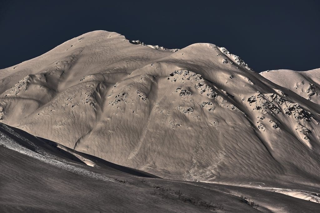
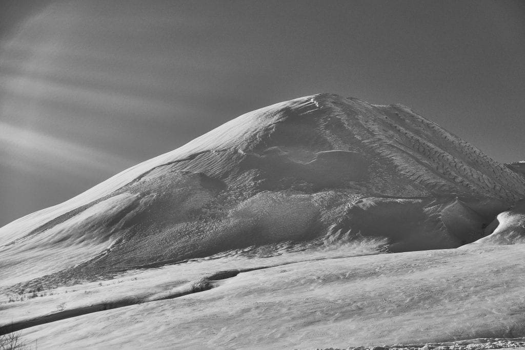
Above: Skyscraper Peak, SSE, 3800′, failed during storm.
Above: Pinnacle Area, Rock Garden, SW, 4200′, failed during the storm.
At all elevations on slopes steeper than 30°, it will be possible to trigger slab avalanches 2+ feet deep on several persistent weak layers. These weak layers include facets on the Chinese New Years drizzle crust, isolated buried surface hoar in the upper snowpack, facets in the mid pack, and facets near the ground.
The last human triggered persistent slab avalanche was Tuesday 2/19 when a snowmachiner remote triggered a large avalanche from the flats near Dogsled Pass.
We are now several days out from the natural avalanche cycle, the snowpack is slowly increasing in stability, but the possibility of triggering a large, dangerous avalanche is still present. With the snowpack still in question, terrain will continue to be the answer.
If you head into the backcountry today, we recommend conservative decision-making. Start out on lower slope angles, avoid the larger slopes, choose slopes with gentle fanning runouts, avoid terrain traps, gather data, and build your stability assessment. Give the snowpack more time to slowly improve.
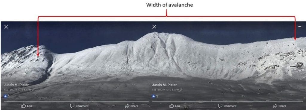
Large avalanche near Dogsled Pass remote-triggered from the flats by a snowmachiner on Tuesday. No one was caught. Thanks Justin Pleier for sharing this information!
Above: Observers have found poor snowpack structure and propagation potential in the low and mid elevations recently.
Human triggered loose dry avalanches will be possible on all aspects, on slopes 40° and steeper. Loose dry avalanches may be high volume and have the ability to carry a person into terrain traps, compounding the hazard. They may be large enough injure or bury a person.
Weather History
Weather at 3450′ since Saturday 2/16:
Temperatures averaged 20°F, with a low of 10°F and a high of 26°F.
Winds averaged SW 4 mph, max 15 mph. Max gusts recorded were S 27 mph .
There has been ~35″ of snow (2.5″ SWE) recorded at Independence Mine since Saturday 2/16.
Weather at 4500′ since Saturday 2/16:
Temperatures averaged 15°F, with a low of 4°F and a high of 21°F.
Winds averaged SE 6 mph, max 28 mph. Gusts averaged SE 11 mph, max gust 40 mph.
Forecast Weather
Stay tuned to the NOAA point forecast for an updated weather forecast each day. The best way to see if it’s snowing in Hatcher Pass is to look at the webcam snow stake HERE and the Independence Mine SNOTEL site HERE
State Parks Snow Report and Motorized Access information can be found here.


