Hatcher Pass
|
 Archives
|
 The Bottom Line
Human triggered deep persistent slab avalanches are possible at all elevations and all aspects on slopes 30º and steeper. Natural avalanches are unlikely. These avalanches will be large to very large in size.
Remotely triggering an avalanche above you or on an adjacent slope is possible.
Avalanche danger has lowered from High to Moderate.
 Special Announcements
Hatcher Pass Road remains closed at mile 11.

 |
|
 |
 |
 |
|
| Travel Advice | Generally safe avalanche conditions. Watch for unstable snow on isolated terrain features. | Heightened avalanche conditions on specific terrain features. Evaluate snow and terrain carefully; identify features of concern. | Dangerous avalanche conditions. Careful snowpack evaluation, cautious route-finding, and conservative decision-making essential. | Very dangerous avalanche conditions. Travel in avalanche terrain not recommended. | Extraordinarily dangerous avalanche conditions. Avoid all avalanche terrain. |
| Likelihood of Avalanches | Natural and human-triggered avalanches unlikely. | Natural avalanches unlikely; human-triggered avalanches possible. | Natural avalanches possible; human-triggered avalanches likely. | Natural avalanches likely; human-triggered avalanches very likely. | Natural and human-triggered avalanches certain. |
| Avalanche Size and Distribution | Small avalanches in isolated areas or extreme terrain. | Small avalanches in specific areas; or large avalanches in isolated areas. | Small avalanches in many areas; or large avalanches in specific areas; or very large avalanches in isolated areas. | Large avalanches in many areas; or very large avalanches in specific areas. | Very large avalanches in many areas. |
A very large avalanche cycle occurred due to the Valentine’s Day storm. Natural avalanches occurred after the President’s Day storm but the avalanche cycle was not as significant as the Valentines Day storm. All photos are from Feb 19th
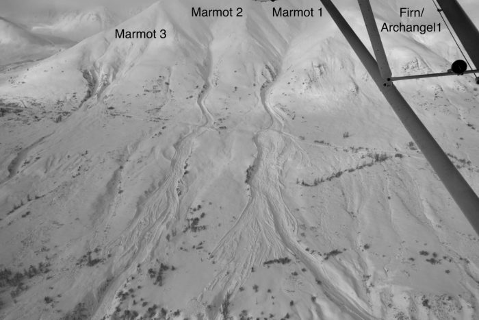
Marmot Avalanche Path’s 1,2,3 and Firn/Archangel1. All of these paths slid in the Valentines’s Day cycle.
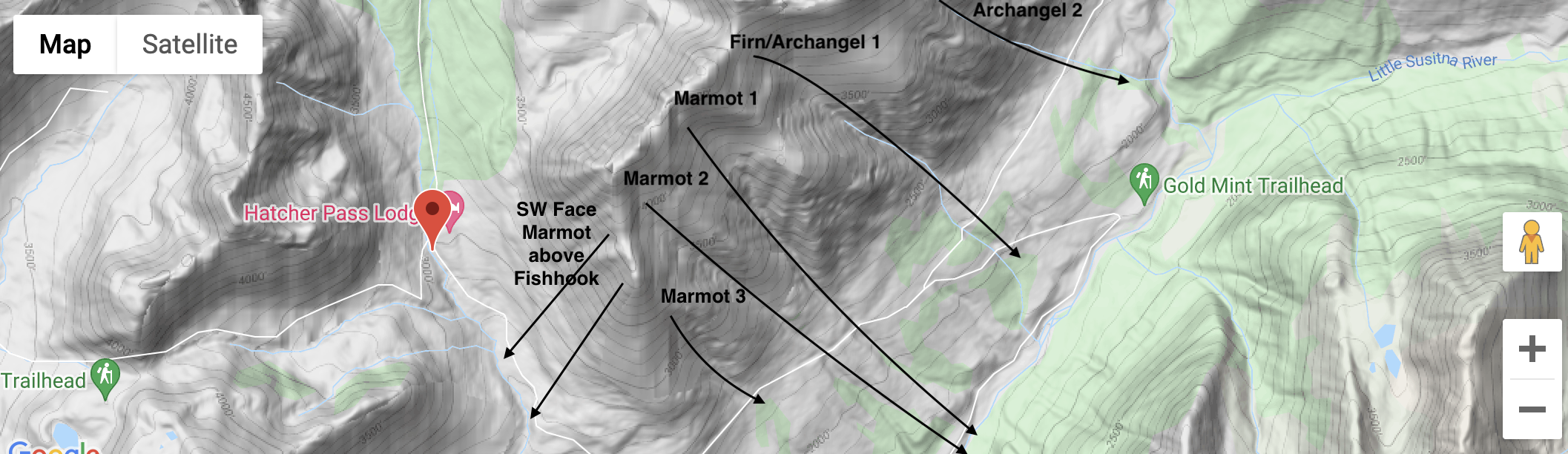
Above: Map of natural avalanches that crossed the road during the Valentines Cycle.
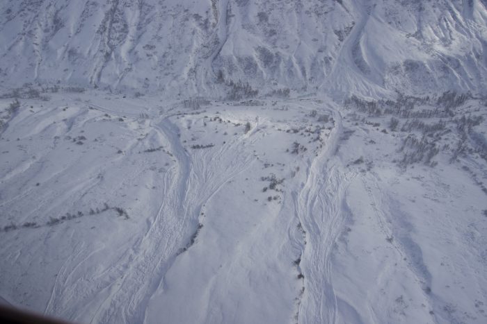
Marmot 1 and 2 cross lower road
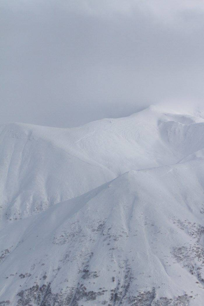
A crown can be seen on the Punk Spines.
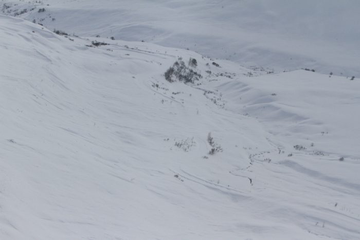
Fishhook Road with avalanche debris.
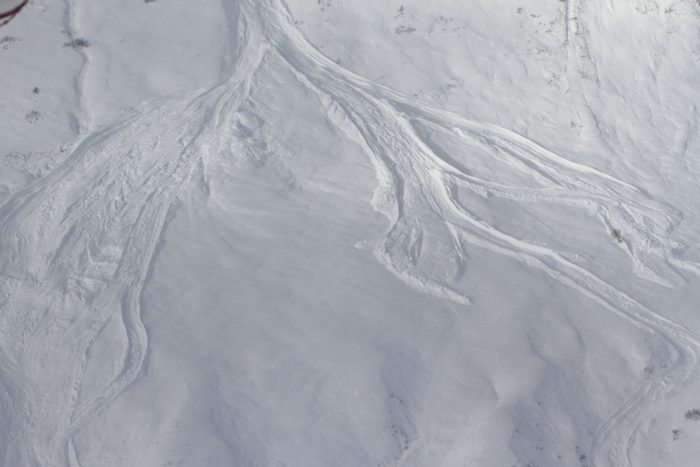
Some interesting avalanche debris.
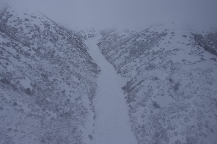
A D4 avalanche in the government peak bowl west of GPRA. The debris is estimated to be 30-40′ deep in places.
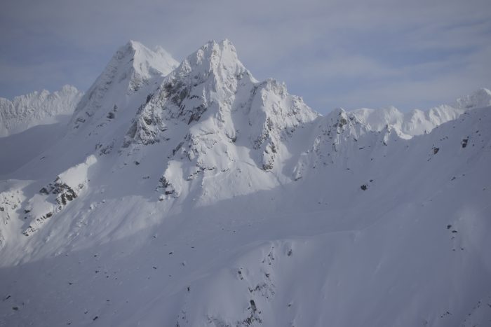
Natural avalanche near Lane Glacier.
| Signal Word | Size (D scale) | Simple Descriptor |
| Small | 1 | Unlikely to bury a person |
| Large | 2 | Can bury a person |
| Very Large | 3 | Can destroy a house |
| Historic | 4 & 5 | Can destroy part or all of a village |
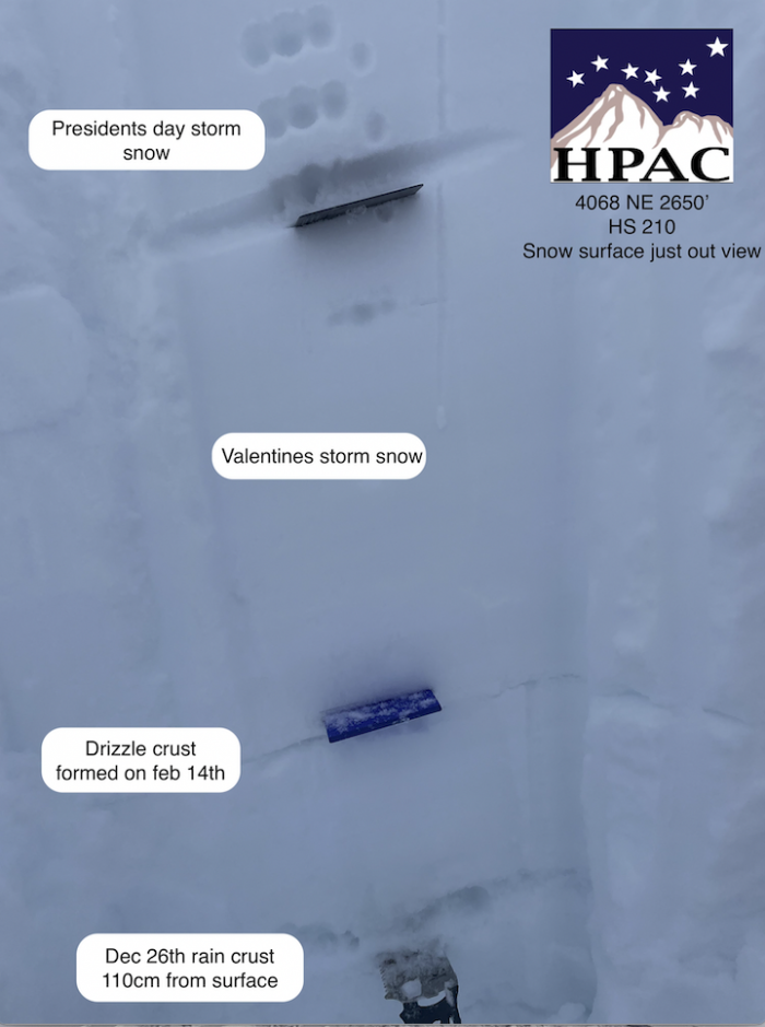
The forecast area has received a large amount of snow from the Valentine’s and President’s day storms. The Valentine’s Day storm(2/14-2/19) brought 50” of snow and 8” of water to the forecast area. The President’s Day storm(2/21-2/22) brought 22” of snow and 3.5” of water. Weak layers that were formed earlier in the season are now buried under 3-4 feet of snow. The persistent slab problem has now transitioned into a deep persistent slab problem.
Human triggered deep persistent slab avalanches up to 4′ deep, are possible at all elevations and on all aspects, on slopes that are 30º degrees or steeper. Natural avalanches are unlikely. These avalanches will be large to very large in size. Remotely triggering an avalanche above you or on an adjacent slope is possible. Deep slabs are inherently more stubborn to trigger because of the depth of the weak layer but carry significantly more consequence. Areas with a thinner snowpack will be more susceptible to human triggered avalanches.
To identify this avalanche problem use poles/probes to identify the Dec 26th rain crust and weak sugary snow below. Formal stability tests will be unreliable due to the fact of weak layers being buried so deep in the snowpack. The layers of concern are buried deeply. This problem will feel unpredictable and give you infrequent feedback. Human triggered avalanches will be possible days or weeks after a storm.
If you choose to enter the backcountry use low risk travel techniques. Spread out when ascending slopes and descend slopes one at a time. Safe zones will be very important when traveling in the mountains. Make sure that you are regrouping in areas that are out of harm’s way. Deep persistent slab avalanches tend to travel further than anticipated and propagate across multiple terrain features..
Some of you may be wondering how we can transition from a High danger rating to Moderate in such a short time frame. In order for the avalanche danger to be at such an elevated level, there needs to be some sort of weather event adding stress or weakening the snowpack. With no weather event (snow/rain, wind or warming) adding stress, the snowpack will continue to gain stability. Most avalanches(natural or human) occur in the first 24-48hrs of a storm. After this time period the snowpack begins to adjust to the new load. While human triggered deep slab and persistent slab avalanches can still occur days and weeks after a weather event, the likelihood begins to decrease.
With warming temperatures at lower elevations, Loose Wet avalanches will be possible on all aspects. These avalanches will be small in size. Pay attention to temperatures and snow surfaces as the day progresses.
The Marmot weather station’s anemometer is still frozen and is not reporting wind speeds.
Valentine’s Day Storm 2/14-2/19 totals:
Independence Mine: 50” of snow and 8” of water.
Frostbite Bottom: 27” of snow and 6.1” of water.
President’s Day Storm 2/21-2/22 totals:
Independence Mine: 22” of snow and 3.5” of water
Frostbite Bottom: 17” of snow and 2.3” of water
NWS AVG Forecast here.
NWS Rec Forecast here.
NWS point forecast here.
State Parks Snow Report and Motorized Access information here.