
Hatcher Pass
|
|
This information is a Conditions Update. Danger ratings are only issued with avalanches advisories. The next avalanche advisory is scheduled for Saturday March 23, 2019.
Previous avalanche advisories HERE
MIDWEEK SNOW AND AVALANCHE CONDITIONS SUMMARY FOR MARCH 21, 2019
Human-triggered wet loose avalanches will be likely and natural avalanches will be possible on all aspects and at all elevations. Wet loose avalanches will be larger on solar aspects. Human-triggered wind slab avalanches will be possible and natural wind slab avalanches will be unlikely, at upper elevations, on W to N aspects. It may be possible, but is generally unlikely, to trigger an avalanche on deeper persistent weak layers.
Happy spring equinox everyone! Unseasonably warm temperatures have reached summit elevations in Hatcher Pass since early Wednesday morning, and as we turn the corner into spring, it’s time to start paying more attention to warming. Rollerballs and especially sinking in deeply in your skis or snow machine are signs that the hazard for wet avalanche activity is increasing. Even small wet loose avalanches can have high consequences if you end up in a terrain trap.
Hatcher Pass received 4″ new snow (0.4” SWE) overnight Monday. The 4″ of snow fell during light winds, but the skiing and riding quality was immediately impacted by warming from the sun on Tuesday and above-freezing temperatures since Wednesday. Snow has since been redistributed across Hatcher Pass due to E to ESE moderate winds gusting to strong and extreme yesterday.
This report is a mid-week conditions update, so please be sure to check hpavalanche.org for advisories on Saturdays and follow the HPAC Facebook for updates. Help us keep tabs on the Hatcher Pass area! If you see any avalanche activity send us an observation HERE. Thank you to everyone who has already submitted observations this season – you can see those HERE!

| |
|
|
|
|
|
| Travel Advice | Generally safe avalanche conditions. Watch for unstable snow on isolated terrain features. | Heightened avalanche conditions on specific terrain features. Evaluate snow and terrain carefully; identify features of concern. | Dangerous avalanche conditions. Careful snowpack evaluation, cautious route-finding, and conservative decision-making essential. | Very dangerous avalanche conditions. Travel in avalanche terrain not recommended. | Extraordinarily dangerous avalanche conditions. Avoid all avalanche terrain. |
| Likelihood of Avalanches | Natural and human-triggered avalanches unlikely. | Natural avalanches unlikely; human-triggered avalanches possible. | Natural avalanches possible; human-triggered avalanches likely. | Natural avalanches likely; human-triggered avalanches very likely. | Natural and human-triggered avalanches certain. |
| Avalanche Size and Distribution | Small avalanches in isolated areas or extreme terrain. | Small avalanches in specific areas; or large avalanches in isolated areas. | Small avalanches in many areas; or large avalanches in specific areas; or very large avalanches in isolated areas. | Large avalanches in many areas; or very large avalanches in specific areas. | Very large avalanches in many areas. |
Above: Wet loose avalanches, Tuesday March 19. Microdot, 4500′, SW aspect.
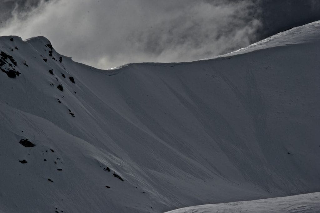
Above: Large cornice-fall triggered avalanche occurred March 17. Rae Wallace Chutes, 4500′, N aspect.
Above: Closer view of the crown of avalanche shown above.
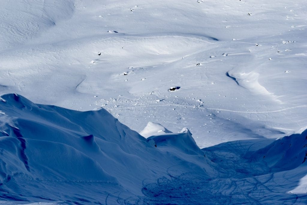
Above: Looking down Rae Wallace Chutes towards debris pile of cornice-fall triggered avalanche from March 17th.
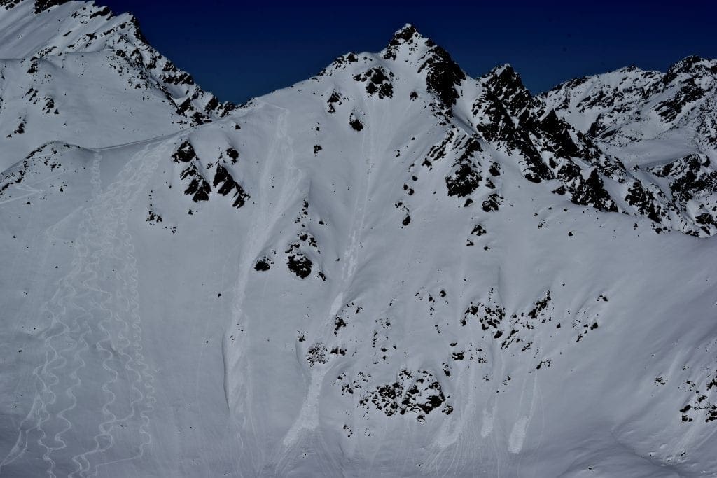
Above: Wet loose avalanches on north aspect of Hatch Peak ridgeline observed Wednesday March 20. 4000′.
Above-freezing temps to 4500’ since 7:00 am yesterday combined with average temps above freezing for 4 days at 3450′, and periods of sunshine today will contribute to wet-loose activity on steep slopes on all aspects and at all elevations, but particularly elevations below 3500’. Human triggered avalanches will be likely and natural avalanches possible. Wet loose avalanches will mostly be small, but on aspects that receive direct sun, southeast to southwest, some of these avalanches may be large enough to bury or injure a person. Note that widespread small natural wet loose avalanches were observed even on north aspects yesterday.
A soft melt-freeze crust is sitting under Tuesday’s new snow. This crust varies in thickness and strength with elevation and aspect. Watch this crust carefully. Once the crust melts, there will be plenty of eager facets, persistently waiting under the crust to contribute to the avalanche problem, increasing the size and consequence of any wet-loose avalanche.

Deeply gouging wet loose avalanche observed on Tuesday March 19. Skyscraper Mountain, 4000′, S Aspect.

Above: Natural wet-loose at low elevation on the road cut, 3/20.
East and East-Southeast moderate winds gusting strong to extreme yesterday and last night have formed fresh wind slabs 6-10” thick in leeward and cross-loaded terrain, on predominantly W to N aspects. Human-triggered wind slab avalanches will be possible and natural wind slabs will be unlikely in upper elevations. These avalanches will be mostly small, but isolated pockets, particularly in extreme terrain could be large enough to bury, injure, or kill a person.
Warm temperatures should allow this avalanche problem to heal relatively quickly. Pole tests can easily reveal stiffer snow sitting over weaker snow and can be a good indicator for the presence of wind slabs and slab thickness. Also be on the lookout for very stiff, hollow sounding or drum-like snow.

Large plumes of blowing snow were observed at ridgetops on Wednesday March 20. Also note wet loose avalanches on this north aspect.
It will be generally unlikely, but may be possible to trigger an avalanche on deeper, buried persistent weak layers, SW to NE aspects, in mid to upper elevations, on slopes steeper than 35 degrees. Particularly suspect are areas where the snowpack is thinner and weaker, such as cross loaded gullies and places where it has previously avalanched. These avalanches may be large enough to bury, injure, or kill a person.
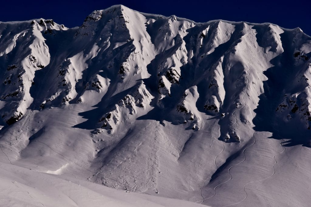
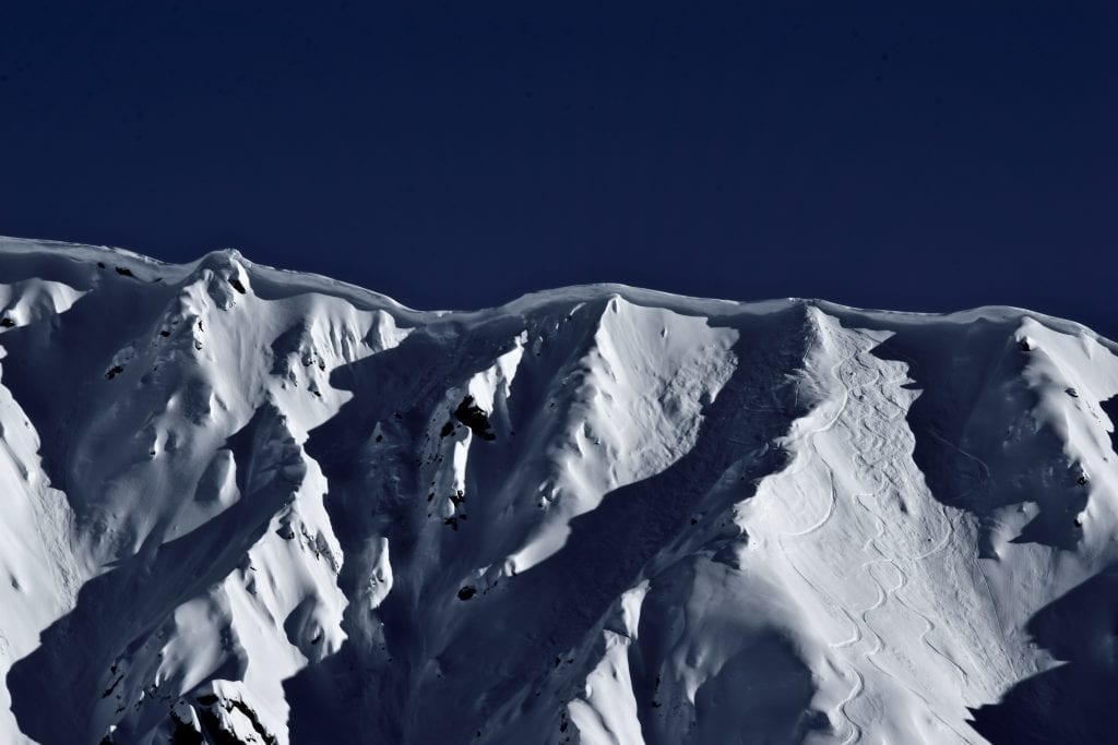
Moderate to strong winds have built large cornices that have proven sensitive to human triggers. Low visibility has made it extremely challenging to see a cornices real magnitude and danger which could increase the likelihood of stepping out too far on an overhung cornice. Give cornices a wide berth as they can break back much further back then they appear and cornices can trigger larger avalanches below. Cornices are extremely unpredictable. It’s best to just avoid them, and minimize your exposure time to minimize your risk, especially on the ascent.

Cornices have grown large and have shown to be sensitive to human triggers in the last week.
Weather History
Weather at 3450′ since Saturday 3/16:
Temperatures averaged 31°F, with a low of 19°F and a high of 42°F.
Winds averaged S 3 mph, max 13 mph. Max gusts recorded were S 39 mph .
There has been 4″ new snow recorded at Independence Mine since 3/16.
Weather at 4500′ since Saturday 3/16:
Temperatures averaged 26°F, with a low of 14°F and a high of 35°F.
Winds averaged SE-ESE 13 mph, max 30 mph. Gusts averaged SE-ESE 23 mph, max gust 57 mph.
Forecast Weather
Stay tuned to the NOAA point forecast for an updated weather forecast each day. The best way to see if it’s snowing in Hatcher Pass is to look at the webcam snow stake HERE and the Independence Mine SNOTEL site HERE
State Parks Snow Report and Motorized Access information can be found here.


