Hatcher Pass
|
 Archives
|
 The Bottom Line
It’s gonna be warm out in the mountains today. Temperatures at 1500-2500’ are expected to reach 43ºF by noon today. Pay attention to what aspect you’re on and snow surfaces if you’re out in the mountains today.
Small human triggered loose wet avalanches will be possible at low and mid elevations on southeast, south and southwest aspects. Natural avalanches will be possible in the afternoon.
On all other aspects and at upper elevations the danger will be low.
Old wind slabs, sun-crusts, and sastrugi can be found on a majority of slopes in Hatcher Pass, making for some challenging riding conditions. Low density snow can be found above 3000’ on protected north facing slopes.


| |
|
 |
 |
 |
|
| Travel Advice | Generally safe avalanche conditions. Watch for unstable snow on isolated terrain features. | Heightened avalanche conditions on specific terrain features. Evaluate snow and terrain carefully; identify features of concern. | Dangerous avalanche conditions. Careful snowpack evaluation, cautious route-finding, and conservative decision-making essential. | Very dangerous avalanche conditions. Travel in avalanche terrain not recommended. | Extraordinarily dangerous avalanche conditions. Avoid all avalanche terrain. |
| Likelihood of Avalanches | Natural and human-triggered avalanches unlikely. | Natural avalanches unlikely; human-triggered avalanches possible. | Natural avalanches possible; human-triggered avalanches likely. | Natural avalanches likely; human-triggered avalanches very likely. | Natural and human-triggered avalanches certain. |
| Avalanche Size and Distribution | Small avalanches in isolated areas or extreme terrain. | Small avalanches in specific areas; or large avalanches in isolated areas. | Small avalanches in many areas; or large avalanches in specific areas; or very large avalanches in isolated areas. | Large avalanches in many areas; or very large avalanches in specific areas. | Very large avalanches in many areas. |
No new slab avalanches were observed this past week. Several wet loose avalanches were observed over the weekend and early in the week.
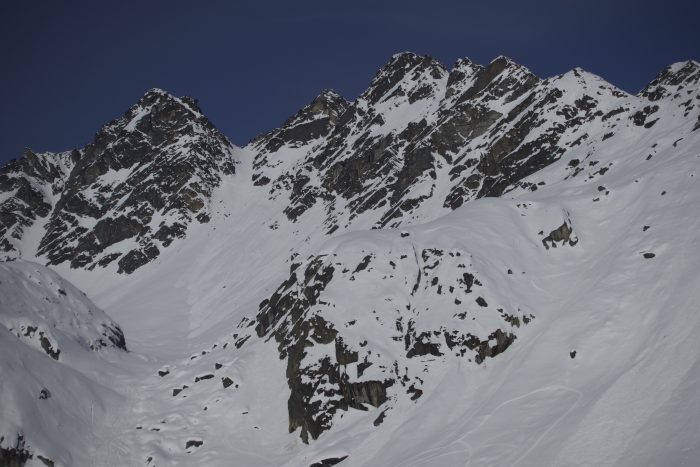
Natural wet loose avalanches in Fairangel valley.
| Signal Word | Size (D scale) | Simple Descriptor |
| Small | 1 | Unlikely to bury a person |
| Large | 2 | Can bury a person |
| Very Large | 3 | Can destroy a house |
| Historic | 4 & 5 | Can destroy part or all of a village |
Human triggered loose wet avalanches are possible at low and mid elevations on southeast, south and southwest aspects. These avalanches will be small in size. These avalanches will be found on slopes steeper than 35 degrees. In the afternoon natural avalanches will be possible.
The weather forecast is calling for temperatures to reach 43ºF by noon today. Timing will be important for finding good snow and avoiding wet avalanche problems. Snow surfaces will be frozen in the morning making for unpleasant riding conditions. By noon snow surfaces will begin to soften, leading to better riding quality but also increased avalanche danger.
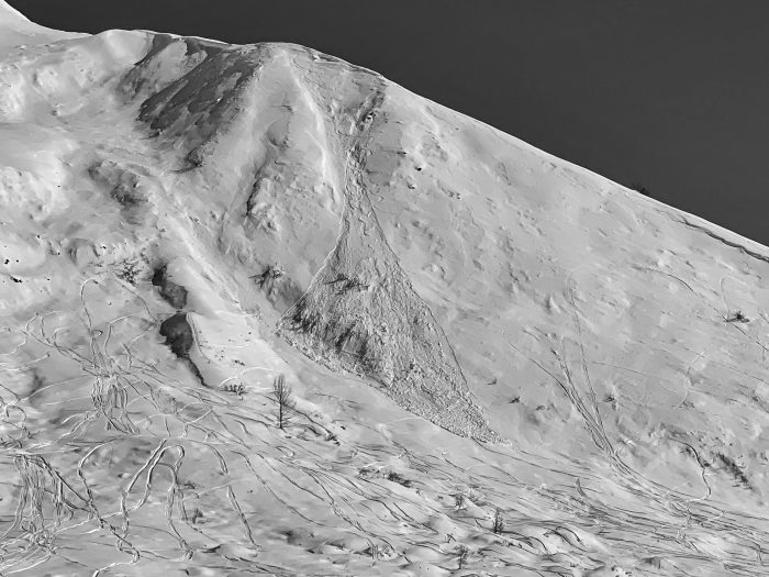
Loose Wet on Divide Ridge.
There are lots of warning signs that snow surfaces are beginning to warm and loose wet avalanches are on their way.
To avoid getting caught in loose wet avalanches, avoid traveling on or below steep slopes in the afternoon. Even a small avalanche can have severe consequences if you’re traveling above terrain trap.
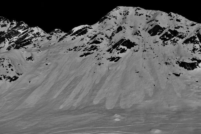
Loose wet avalanches in Archangel Valley. This is good example of how rock bands warm up quickly.
It’s that time of year where there’s significant warming during the day. Ridge tops weather stations are remaining cool but Frostbite weather station has reordered some significant temperatures over the last few days.
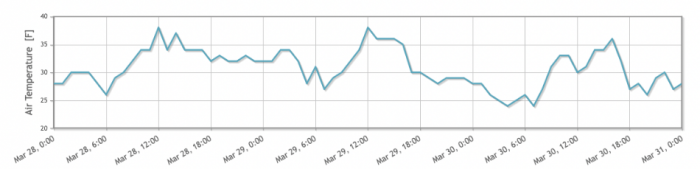
Frostbite Station 2700′
NWS AVG Forecast here.
NWS Rec Forecast here.
NWS point forecast here.
State Parks Snow Report and Motorized Access information here.