Hatcher Pass
|
 Archives
|
 The Bottom Line
It will be possible to human trigger or remotely trigger a 1-3 ft. thick persistent slab avalanche on all aspects, at all elevations, on slopes 30º and steeper today.
There is a lot of spatial variability out there due to recent strong winds re-distributing snow earlier in the week. Conditions are highly variable, consisting of supportable and breakable wind board, old crusts, wind scoured ridges, cross loaded gullies, and in some areas the snowpack is almost entirely weak, sugary facets. The snowpack varies from 1 to 6 feet deep, and this variation can be found across a slope in as short a distance as 50 feet.
Few people have ventured far into the upper elevation terrain at Hatcher Pass this week. Let this be a reminder that the lack of recent human triggered avalanches does not necessarily correlate to safety or stability. Instead, it is a time to ask more questions of the snowpack, make appropriate terrain decisions, and use safe travel protocol.
16 Mile Report: Use caution on steep slopes, in terrain traps, and gullies where stiff slabs over weaker snow may result in avalanches.
 Special Announcements
This week’s forecast is sponsored by the Mat-Su Health Foundation.
Happy Holidays, and thank you for your generous support of HPAC!


 |
|
 |
 |
 |
|
| Travel Advice | Generally safe avalanche conditions. Watch for unstable snow on isolated terrain features. | Heightened avalanche conditions on specific terrain features. Evaluate snow and terrain carefully; identify features of concern. | Dangerous avalanche conditions. Careful snowpack evaluation, cautious route-finding, and conservative decision-making essential. | Very dangerous avalanche conditions. Travel in avalanche terrain not recommended. | Extraordinarily dangerous avalanche conditions. Avoid all avalanche terrain. |
| Likelihood of Avalanches | Natural and human-triggered avalanches unlikely. | Natural avalanches unlikely; human-triggered avalanches possible. | Natural avalanches possible; human-triggered avalanches likely. | Natural avalanches likely; human-triggered avalanches very likely. | Natural and human-triggered avalanches certain. |
| Avalanche Size and Distribution | Small avalanches in isolated areas or extreme terrain. | Small avalanches in specific areas; or large avalanches in isolated areas. | Small avalanches in many areas; or large avalanches in specific areas; or very large avalanches in isolated areas. | Large avalanches in many areas; or very large avalanches in specific areas. | Very large avalanches in many areas. |
Old, weak layers in the snowpack were re-activated once again this week. New snow and wind earlier in the week resulted in several large natural avalanches on 12/21-22 on all aspects and elevations. Most notably were large naturals in Martin Mine (D2), April Bowl (D2), Eldorado (D2x3), Microdot (D2). Towards the end of the week we experienced benign weather.
No recent avalanches have been observed since 12/22.
One remotely human triggered avalanche reported this week, see picture below:
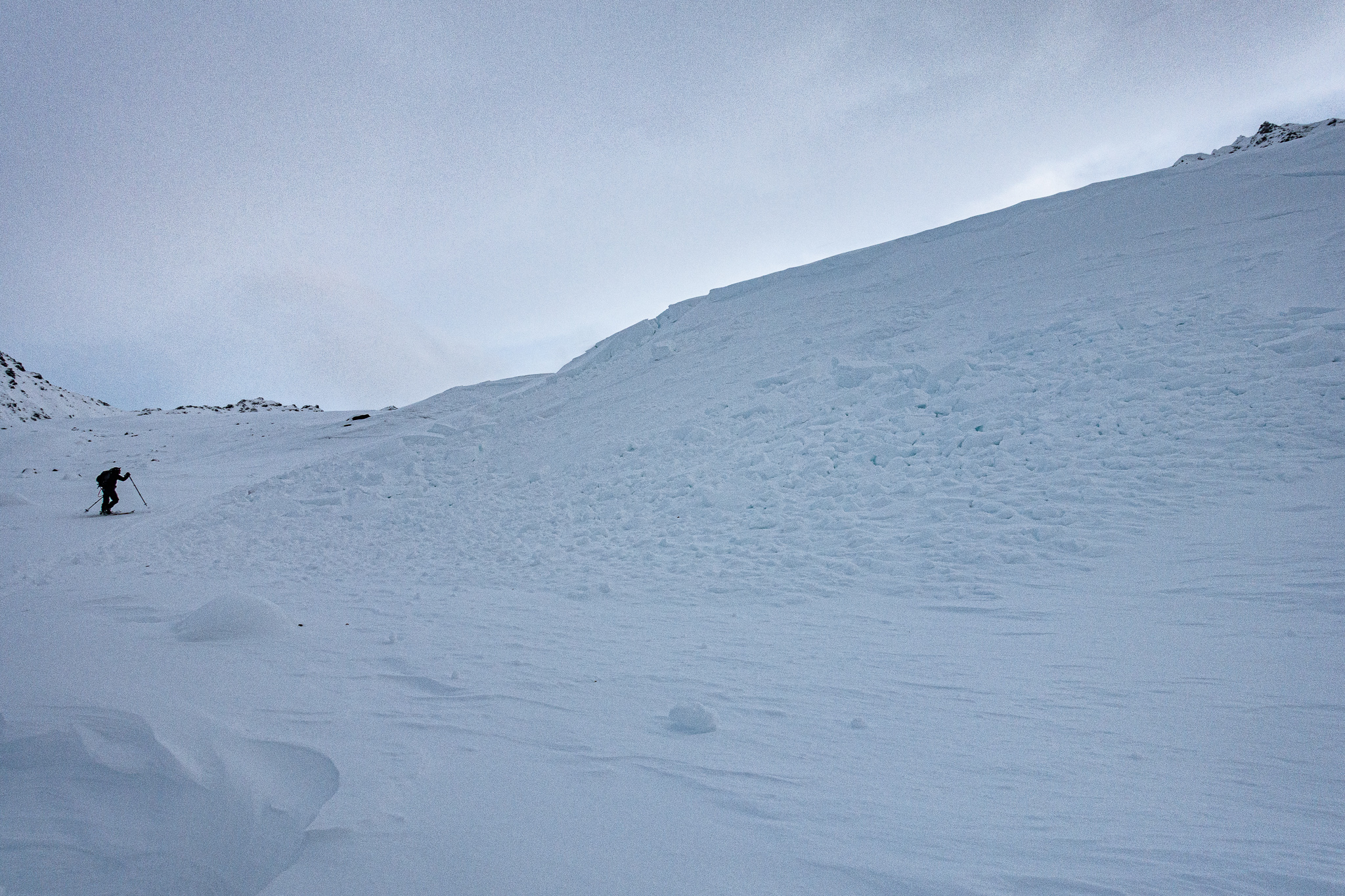
12/22/2020 Above Sledding Hill, W, 3400′, Remotely human triggered from 200′ away
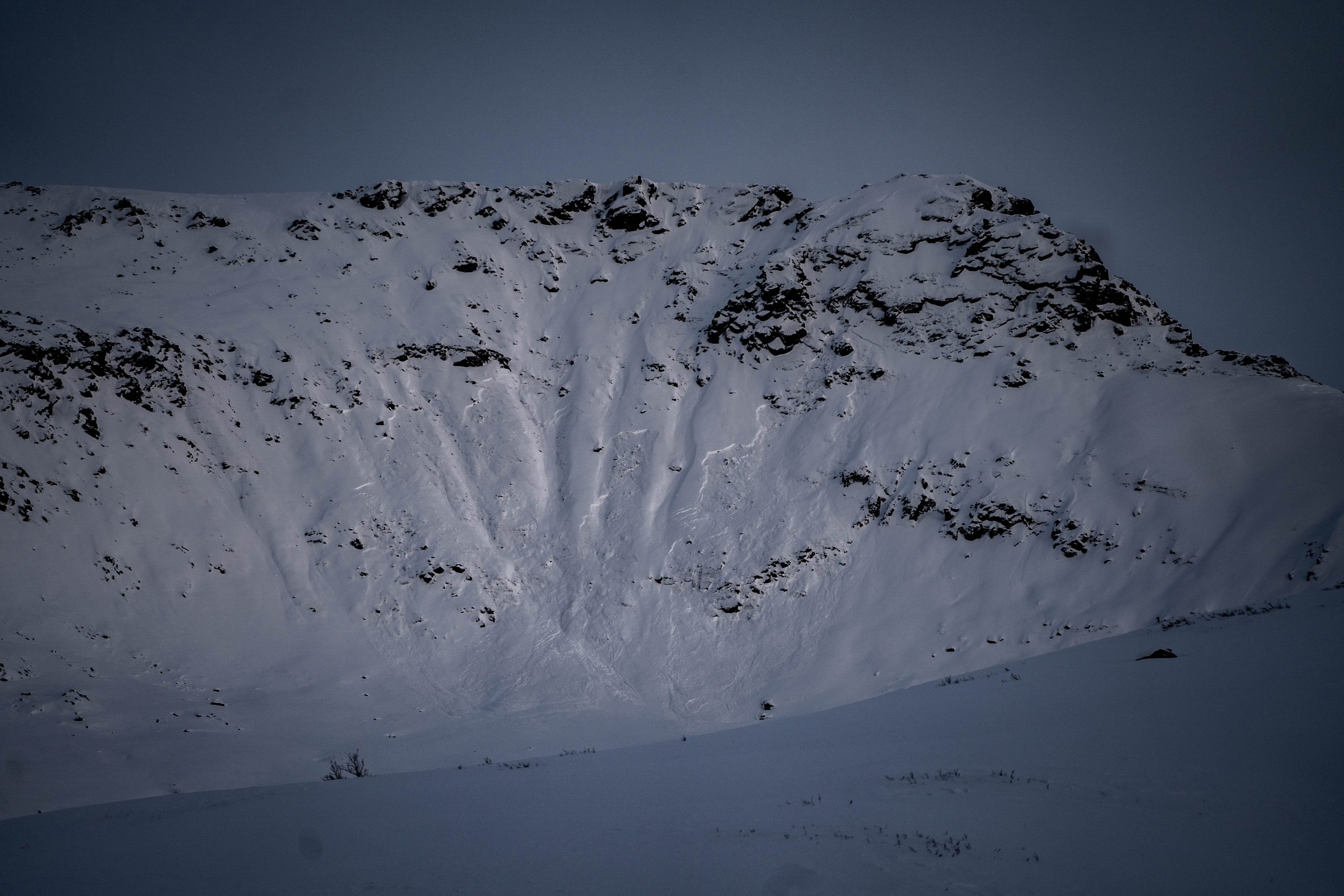
12/21-22/2020 Gold Bullion, Willow side of HP, Tsunami Wall, SW, 4800′. Size D2. Failed on mid-pack near surface facets. Wide propagation, wraps terrain features.
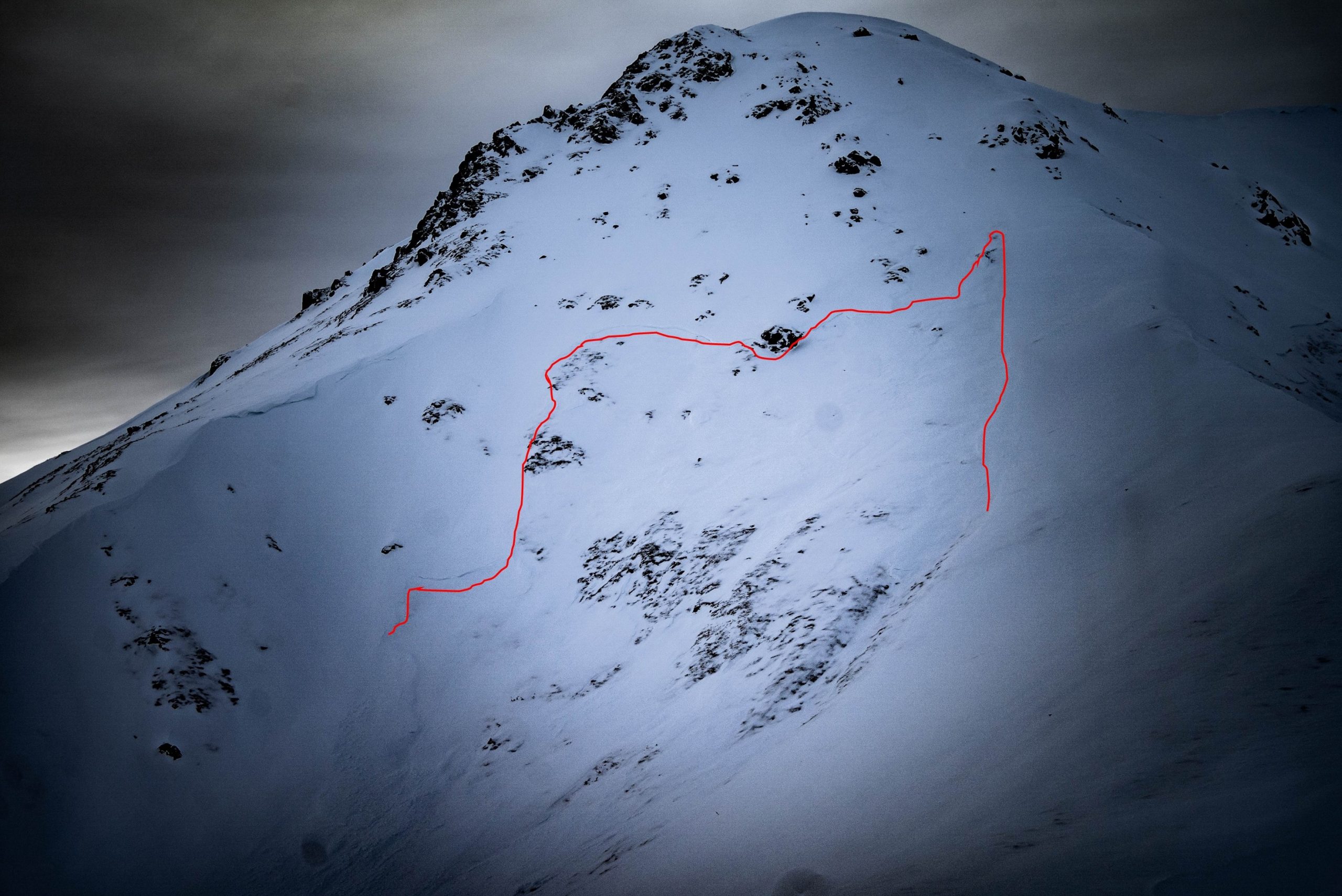
12/21-22/2020 – Skyscraper, Liam’s Run, NW, 4150′. Size D2. Overran the standard debris zone in hanging bowl, into the gully, and to the valley floor. Crown marked in red.
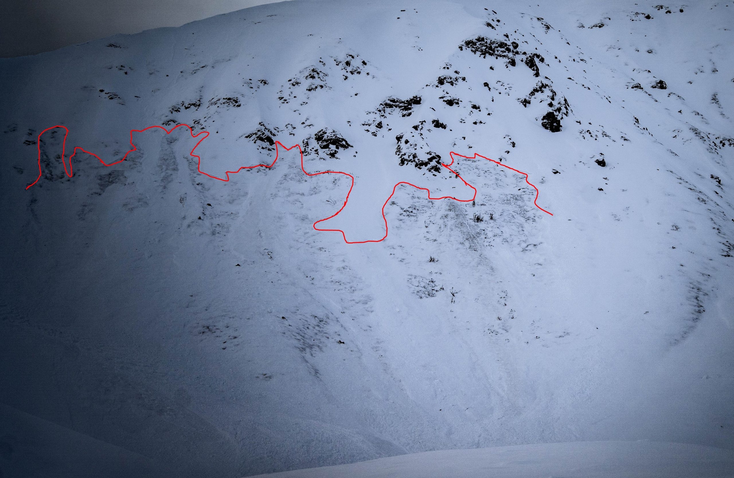
12/21-22/2020 Skyscraper, NE, 4300′. Size D2.5. Wide propagation, failing near the ground. Check out partially obscured debris pie in lower left of photo. Crown marked in red.
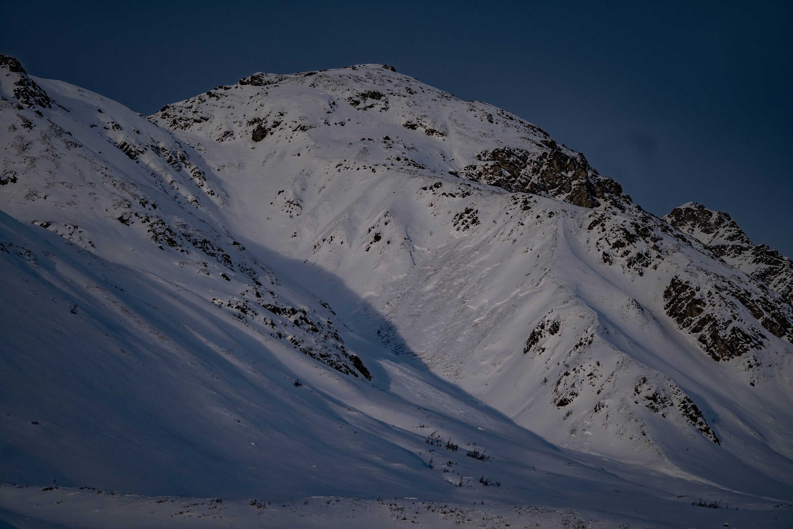
12/21-22/2020 Repeat offender this season. Martin Mine on the flanks of Granite Mountain, South, 4000′. Size D2. Wide propagation on weak faceted snow.

12/21-22/2020 – Microdot, SSW, 4500′, Natural avalanche during or just after storm. D2 in size. Avalanche propagated around terrain features, wide propagation. Failure at basal facets and mid-pack Near Surface Facets.
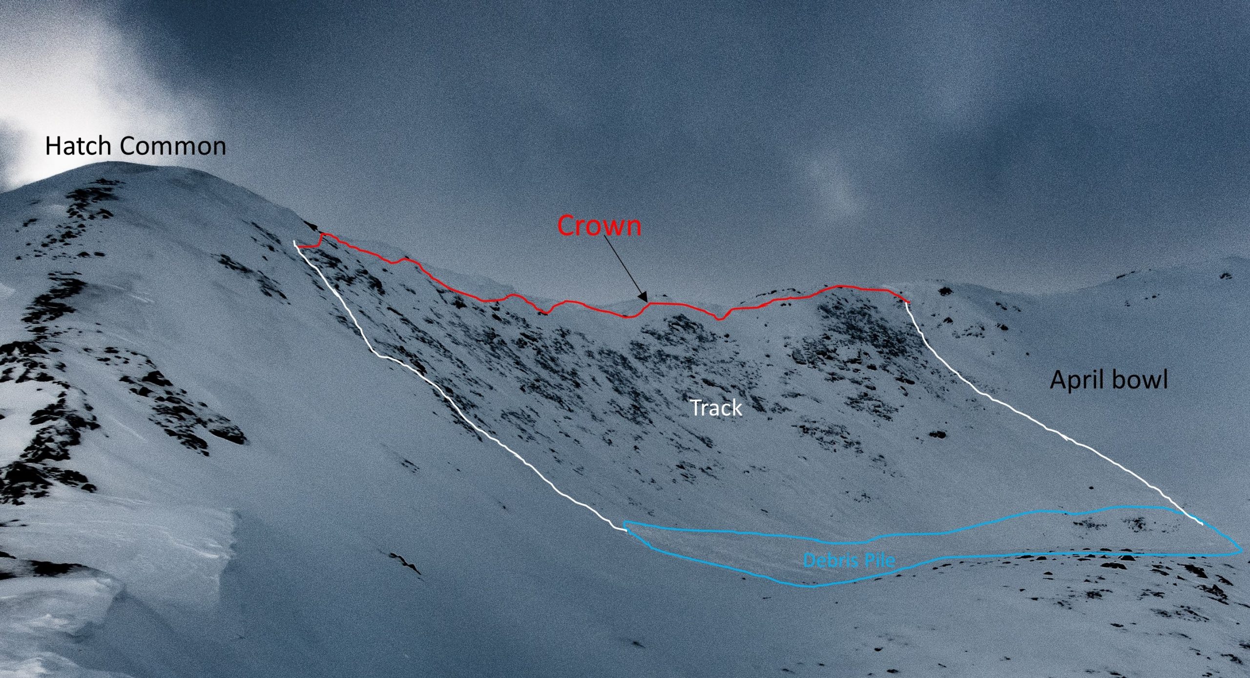
12/21-22/2020 April Bowl N/NW 4700′ Natural D2.
| Signal Word | Size (D scale) | Simple Descriptor |
| Small | 1 | Unlikely to bury a person |
| Large | 2 | Can bury a person |
| Very Large | 3 | Can destroy a house |
| Historic | 4 & 5 | Can destroy part or all of a village |
Persistent slabs, 1-3 feet deep, will be possible to human trigger, or remotely trigger today, on all aspects, at all elevations, on slopes 30° and steeper. Triggering any avalanche will have the added hazard rocks.
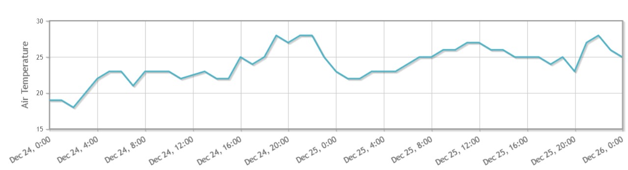
Warm temperatures, a lack of significant precipitation, and light winds this weekend will aid in the continued, but slow trending, increase in stability.
Approximately 16″ of new snow and strong winds this week overloaded our loathed persistent slab resulting in a natural avalanche cycle on 12/21 and 22 on all aspects and at all elevations. The same structural problem that resulted in natural avalanches earlier in the weak, will continue to be a problem for human triggering this weekend.
Two widespread, persistent, faceted weak layers exist in the snowpack, one mid pack and the other at the base of the snowpack. Both weak layers were culprits in several avalanches this week, which resulted in wide propagation, and some avalanches failing in the upper weak layer and then stepping down into the deeper weak layer near the ground. These layers will continue to be the main problems this weekend.
For the recipe to be ripe, we need to have a slab sitting on a weak layer. Because the slab component has been re-distributed by recent strong winds, there is a lot of special variability. In some areas the snowpack is almost completely comprised of weak snow, and lacks the slab component. In other areas we are finding stiff slabs over weak snow, creating the set up for dangerous avalanches. Predicting and identifying exactly where the slab/weak layer is located will be difficult, even for the expert eye.
Red flags for this avalanche problem are whumphing, shooting cracks, stiff snow sitting over weaker snow, and poor instability test results. Any one pit will not give you the entire picture of the snowpack’s stability due to spatial variability. Pole and probe tests will be a good techniques for assessing snow depth, and where cohesive slabs sitting over weaker snow exist and where they do not.
It’s a bit of a poker game. In these gambling situations stack the odds in your favor; gather all the information you can through the forecast, recent observations, weather stations, and your in-field assessments, and then pony up a large dose of conservative travel protocol, and combine that with smart terrain choices, ie. slopes that lack terrain traps. If you aren’t the gamblin’ type, avoid the hazard altogether, and stick to slopes less than 30° and out of the runout of slopes 30º and steeper, where triggering a persistent slab is unlikely.
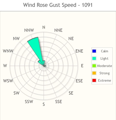
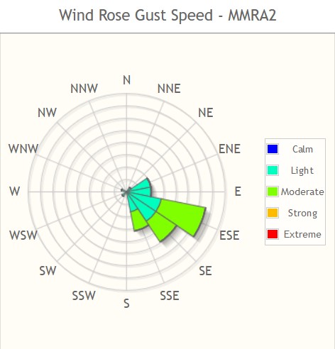
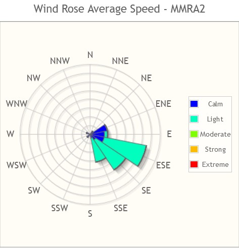
This week started out with some exciting weather, new snow, and extreme winds! On Sunday independence mine received 8” of new snow, temps remained in the single digits. On Monday winds increased at Marmot and Independence Mine with gusts reaching 28 mph lasting for approximately 8 hrs. Late Monday winds increased, with gusts reaching almost 50mph at both the marmot and independence mine. These winds lasted for about 14hrs. On Wednesday winds tapered and another 8” of new snow fell at independence mine. Since Thursday the winds tapered off and we have had relatively benign weather, with generally cloudy and overcast skies.
Today we are expecting clouds with 1-2″ of snow accumulation tonight, light SE winds, and temperatures cooling to 17°F at 1000′ by this evening with a possible inversion and slightly warmer temps up high.
Precip
New snow this week 12/20-26
Independence Mine: 16″
Frostbite Ridge: 6″
Wind 12/24-26
Independence Mine
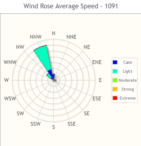
Marmot
Temp 12/24-26
Independence Mine
NWS Rec Forecast here.
NWS point forecast here.
State Parks Snow Report and Motorized Access information here.