Hatcher Pass
|
 Archives
|
 The Bottom Line
Not much has changed, we remain in an impressively long holding pattern.
Today’s avalanche problem will be, you guessed it, Loose Dry.
Cold weather has preserved loose snow near the surface which will be possible to human trigger at mid and upper elevations in specific terrain, 40º and steeper. While these avalanches will be small in size, they will move quickly and be capable of sweeping you off your feet into other hazards, such as shallowly buried rocks and cliffs.
Natural avalanches are unlikely.
 Special Announcements
Giving Tuesday is coming up in three days on November 30. Make sure to donate to HPAC on this important day. You can donate by pressing the Donate Button or visiting us on Facebook.


| |
|
 |
 |
 |
|
| Travel Advice | Generally safe avalanche conditions. Watch for unstable snow on isolated terrain features. | Heightened avalanche conditions on specific terrain features. Evaluate snow and terrain carefully; identify features of concern. | Dangerous avalanche conditions. Careful snowpack evaluation, cautious route-finding, and conservative decision-making essential. | Very dangerous avalanche conditions. Travel in avalanche terrain not recommended. | Extraordinarily dangerous avalanche conditions. Avoid all avalanche terrain. |
| Likelihood of Avalanches | Natural and human-triggered avalanches unlikely. | Natural avalanches unlikely; human-triggered avalanches possible. | Natural avalanches possible; human-triggered avalanches likely. | Natural avalanches likely; human-triggered avalanches very likely. | Natural and human-triggered avalanches certain. |
| Avalanche Size and Distribution | Small avalanches in isolated areas or extreme terrain. | Small avalanches in specific areas; or large avalanches in isolated areas. | Small avalanches in many areas; or large avalanches in specific areas; or very large avalanches in isolated areas. | Large avalanches in many areas; or very large avalanches in specific areas. | Very large avalanches in many areas. |
There were numerous small human triggered avalanches this week. These avalanches were found on slopes 40° or steeper.
No slab avalanches were reported or observed this week.
| Signal Word | Size (D scale) | Simple Descriptor |
| Small | 1 | Unlikely to bury a person |
| Large | 2 | Can bury a person |
| Very Large | 3 | Can destroy a house |
| Historic | 4 & 5 | Can destroy part or all of a village |
November’s bone chilling weather and lack of wind and precipitation continues to preserve the Loose Dry avalanche problem (sluffs).
Loose dry avalanches will be possible to human trigger on all aspects, at mid to upper elevations, on slopes 40º and steeper. They will be small in size but fast moving and capable of sweeping you off your feet and into other hazards such as shallowly buried rocks, compounding the hazard.
Natural avalanches are unlikely.
Fresh, undisturbed snow slopes have a much greater chance for loose dry avalanche problems. Slopes that have been heavily tracked are less of a concern. Use slope cuts in steep terrain to test the snow and watch its behavior before committing to the slope. Fast moving sluffs behave like moving water, high ground is generally safer, troughs and depressions are gathering zones where the volume of loose dry avalanches are more likely to exceed your ability to mitigate this hazard.
This video below shows the current character of the loose dry problem.
The entire snowpack has been weakening through the faceting process. Finding stiff, cohesive snow that could act as a slab is extremely unlikely. This is one of those times when weak, faceted snow is not contributing to a dangerous slab avalanche problem. However, this faceted snow will become a problem for dangerous avalanches once it is buried. This can happen either by precipitation or by wind drifting.
We don’t expect to see much snow in the next pulse headed our way, Monday through Wednesday, and currently we are only seeing a total of 6″ of snow in the 10 day forecast. All of this can change fast as long term weather forecasting is not exact. Keep a close eye on the wind speeds using the Marmot Weather Station as a quick check before heading into the backcountry. If winds pick up above 12mph for for an extended period of time, wind slabs will be forming and the avalanche danger will rise.
Most of the low hanging fruit at Hatcher has been heavily ridden. These locations will have less likelihood for triggering loose dry avalanches, but not impossible.
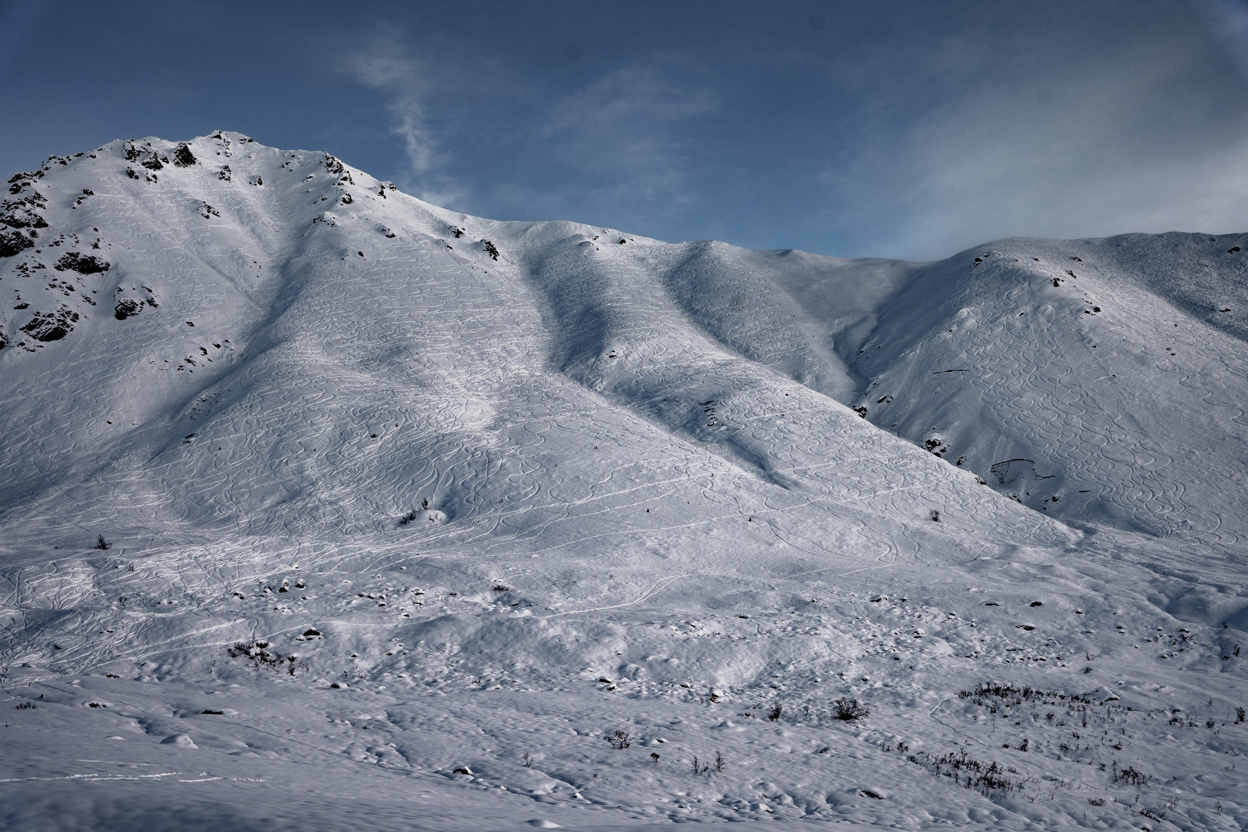
Marmot, showing heavy backcountry use from November. If someone was going to find a slab avalanche problem on this slope, we would have seen one by now.
We’ve been talking about loose dry avalanches since the November 11 forecast. This messaging is getting repetitive. In an effort to spice it up, we looked at some low elevation snow yesterday and here is what we found. The good news is that we don’t have any alarm bells to report, the bad news is forecasters are getting depressed with little avalanche content to report.
If you get out into the backcountry, please share your observations and photos with the community HERE.