
Hatcher Pass
|
|
This information is a Conditions Update. Danger ratings are only issued with avalanches advisories. The next avalanche advisory is scheduled for Saturday January 19, 2019.
Previous avalanche advisories HERE
MIDWEEK SNOW AND AVALANCHE CONDITIONS SUMMARY
While the likelihood of triggering a slab avalanche is decreasing slowly with time, there is still a possibility of triggering an avalanche large enough to bury, injure, or kill a person. Evaluate snow and terrain carefully, identifying features of concern.
Hatcher Pass has had mild temperatures, clear skies, and for the most part, light to moderate winds this week. The unfortunate exception to this was a strong SE wind event on last Saturday night and Sunday that left the landscape significantly wind affected.
The last known human-triggered slab avalanche was during the New Year’s storm wind event on 12/30/18. The last natural slab avalanches occurred during the wind event on Saturday 1/12 and Sunday 1/13.
Surface conditions currently range from bare ground on windward ridgeline features, to breakable wind crust, to 2-10″ thick slick, supportable wind slab. Public observers have reported that pockets of good skiing and riding conditions can still be found in protected areas.
This report is a mid-week conditions update, so please be sure to check hpavalanche.org for advisories on Saturdays and follow the HPAC Facebook for updates. Help us keep tabs on the Hatcher Pass area! If you see any avalanche activity send us an observation HERE. Thank you to everyone who has already submitted observations this season – you can see those HERE!

Some of the more dramatically wind affected terrain in Hatcher Pass. South aspect of Bullion Mountain, Willow Creek area.

Wind effect visible on Marmot Mountain.
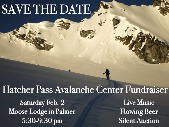
Buy tickets for the event here. We will have the award-winning band Tanana Rafters.
Unable to make it to our fundraiser? Consider donating to keep avalanche information like this coming from HPAC!
Want to donate a silent auction item or help with the fundraiser? Contact us at info@hpavalanche.org
| |
|
|
|
|
|
| Travel Advice | Generally safe avalanche conditions. Watch for unstable snow on isolated terrain features. | Heightened avalanche conditions on specific terrain features. Evaluate snow and terrain carefully; identify features of concern. | Dangerous avalanche conditions. Careful snowpack evaluation, cautious route-finding, and conservative decision-making essential. | Very dangerous avalanche conditions. Travel in avalanche terrain not recommended. | Extraordinarily dangerous avalanche conditions. Avoid all avalanche terrain. |
| Likelihood of Avalanches | Natural and human-triggered avalanches unlikely. | Natural avalanches unlikely; human-triggered avalanches possible. | Natural avalanches possible; human-triggered avalanches likely. | Natural avalanches likely; human-triggered avalanches very likely. | Natural and human-triggered avalanches certain. |
| Avalanche Size and Distribution | Small avalanches in isolated areas or extreme terrain. | Small avalanches in specific areas; or large avalanches in isolated areas. | Small avalanches in many areas; or large avalanches in specific areas; or very large avalanches in isolated areas. | Large avalanches in many areas; or very large avalanches in specific areas. | Very large avalanches in many areas. |
Natural wind slab avalanches from last weekend’s wind event were spotted on Monday.

Natural wind slab avalanche on west aspect of ridgeline between Skyscraper and Granite Mtns.

Natural wind slab avalanche on east aspect in cross loaded gully directly north of Martin
Persistent weak layers in the snowpack still exist, but are slowly stabilizing over time. While the likelihood of triggering a slab avalanche is decreasing, the possibility is still present, and the consequences could be high. The likelihood of triggering an avalanche will be greater above 3000’, on all aspects, on slopes 35° and steeper.
The snowpack depth is highly variable, from 1-5 feet deep, with the deepest snowpack at upper elevations, on West to North aspects, due to wind loading through the season. Triggering an avalanche on these leeward aspects will be more consequential than windward, shallower aspects due to the amount of snow involved. Windward aspects are scoured down to rock and tundra in many location above 3000′.
On leeward aspects along ridgelines and cross loaded features, a hard 2-10″ thick slab has been deposited by last weekend’s winds. This slab can be found sitting on loose, faceted snow. Observers on Tuesday reported whumphing on a set-up like this in Upper Willow Creek. On Wednesday, these slabs were found to be stubborn to unreactive on North aspects between 4000-4500′.
One of the biggest things we can do to increase our margin of safety is to choose slopes with gentle fanning run-outs and avoid terrain traps. Unsupported slopes in steep, shallow, rocky terrain will be more likely to harbor the avalanche problem.
Keep in mind that the poor structure of our snowpack won’t be going away anytime soon, and any new rapid load may re-activate weak layers in our snowpack.

Snow pit in Upper Willow Creek on Skyscraper’s west aspect showing our widespread poor structure: a dense slab sitting on two distinct layers of weak, faceted snow at the base of the snowpack.
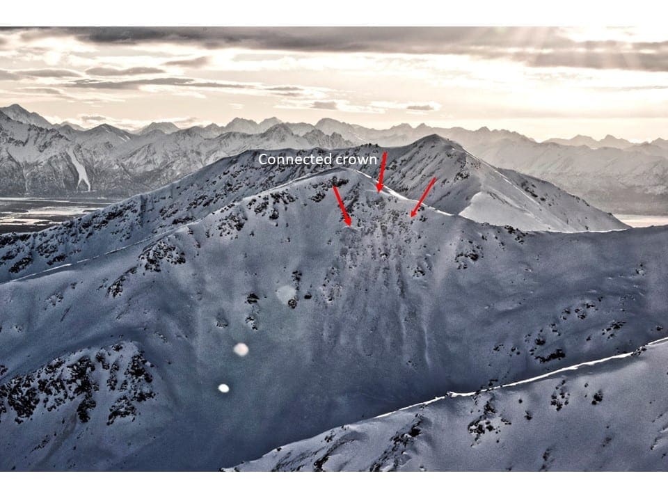
Old natural persistent slab avalanche from New Years wind event on north aspect of Peak 4600′, north of Gov’t Peak. Large avalanches like this are still possible to trigger, especially on steep, rocky, unsupported slopes above 3000′.

Hard 2-10″ thick wind slabs have formed over loose, faceted snow in places. Whumphing was reported by observers in a spot where this structure was found.
Weather History
Weather at 3450′ since Saturday 1/12:
Temperatures averaged 28°F, with a low of 14°F and a high of 34°F.
There has been no new precipitation.
Weather at 4500′ since Saturday 1/12:
Temperatures averaged 25°F, with a low of 10°F and a high of 32°F.
Winds averaged SE 8 mph, max 21 mph. Gusts averaged SE 14 mph, max gust 43 mph.
Forecast Weather
Stay tuned to the NOAA point forecast for an updated weather forecast each day. The best way to see if it’s snowing in Hatcher Pass is to look at the webcam snow stake HERE and the Independence Mine SNOTEL site HERE
State Parks Snow Report and Motorized Access information can be found here.


