
Hatcher Pass
|
|
A LOW avalanche hazard exists at all elevations and on all aspects. While it is unlikely to trigger avalanches today, it is not impossible. Anticipate the possibility of small avalanches in isolated or extreme terrain. Low does not mean no hazard.
Be cautious in consequential terrain where even small avalanches in isolated locations could carry you into terrain traps, such as rocks and cliffs, compounding the hazard.
A shallow showpack with exposed rocks and hazards exists in many locations. Challenging travel conditions, such as breakable crust and extra firm snow surfaces are widespread. Soft snow can be found in isolated locations at mid to upper elevations, in wind sheltered areas, and at the lower elevations.
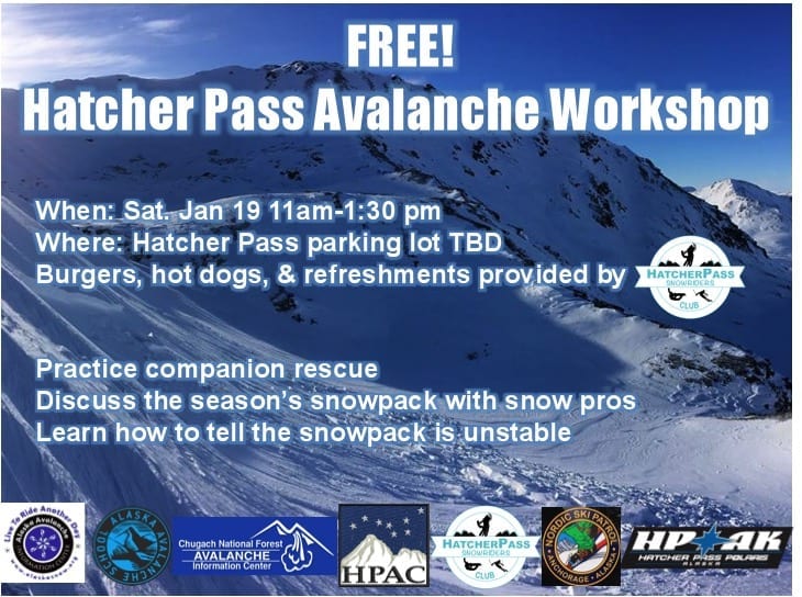
Today is the annual Hatcher Pass Avalanche Workshop. Please carpool as parking is limited.
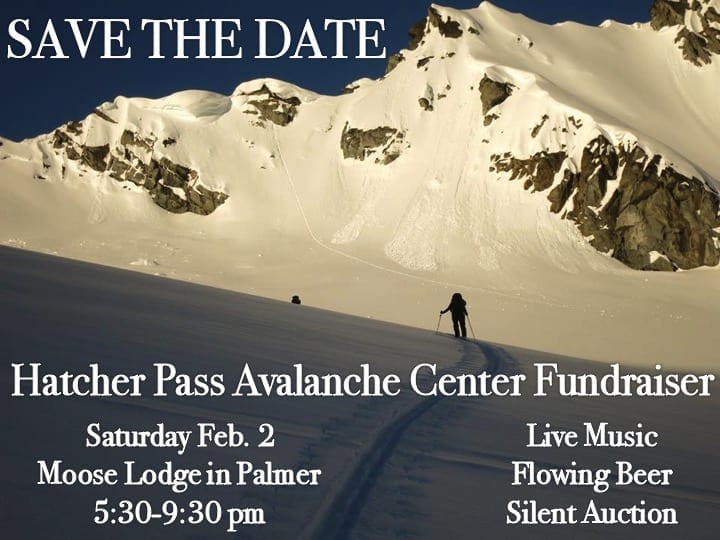
Save the date: HPAC Annual Fundraiser and Cabin Fever Reliever, Saturday,February 2, 2019 at the Moose Lodge in Palmer. Tickets available now for $20 HERE or $25 at the door.
Come dance and celebrate winter with the rippin’ band, the Tanana Rafters- bid on silent auction items- and sip local beer and Double Shovel Cider!
| |
|
|
|
|
|
| Travel Advice | Generally safe avalanche conditions. Watch for unstable snow on isolated terrain features. | Heightened avalanche conditions on specific terrain features. Evaluate snow and terrain carefully; identify features of concern. | Dangerous avalanche conditions. Careful snowpack evaluation, cautious route-finding, and conservative decision-making essential. | Very dangerous avalanche conditions. Travel in avalanche terrain not recommended. | Extraordinarily dangerous avalanche conditions. Avoid all avalanche terrain. |
| Likelihood of Avalanches | Natural and human-triggered avalanches unlikely. | Natural avalanches unlikely; human-triggered avalanches possible. | Natural avalanches possible; human-triggered avalanches likely. | Natural avalanches likely; human-triggered avalanches very likely. | Natural and human-triggered avalanches certain. |
| Avalanche Size and Distribution | Small avalanches in isolated areas or extreme terrain. | Small avalanches in specific areas; or large avalanches in isolated areas. | Small avalanches in many areas; or large avalanches in specific areas; or very large avalanches in isolated areas. | Large avalanches in many areas; or very large avalanches in specific areas. | Very large avalanches in many areas. |
Natural loose dry avalanches from this week were observed yesterday, see picture under Loose Dry Avalanche Problem.
An isolated, very small, skier triggered slab from previous wind loading, 2-10″ thick, was triggered on a south aspect at approximately 4500′ yesterday. The skier was not carried or caught.
Natural wind slab avalanches from last weekend’s wind event (1/12 – 1/13) were spotted on Monday.

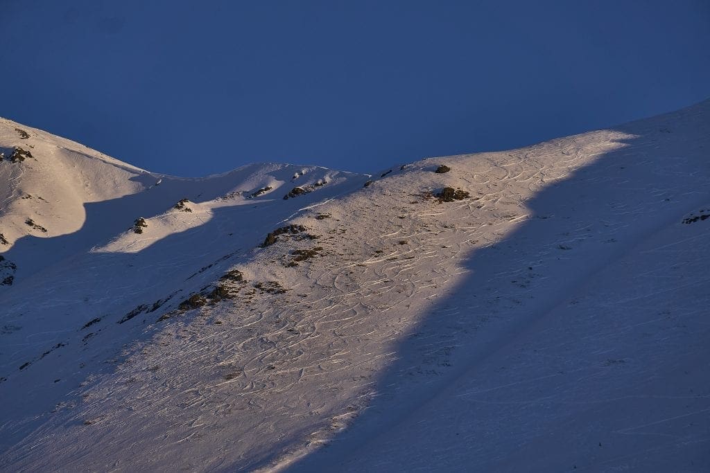
Above: Natural wind slab avalanche on west aspect of ridgeline between Skyscraper and Granite Mtns.

Above: Natural wind slab avalanche on east aspect in cross loaded gully directly north of Martin Gully
Conditions photos:
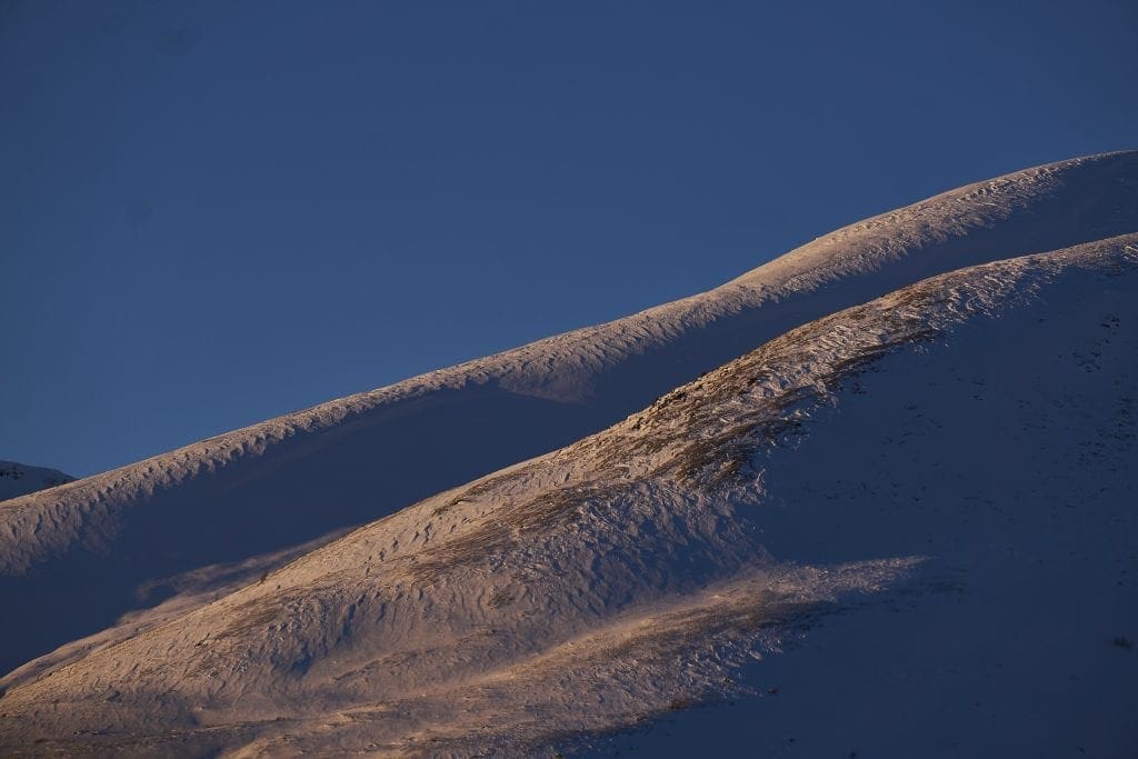
Above: Wind scouring on East ridge of peak 4068.
Above: Raised tracks on Marmot, SW face.
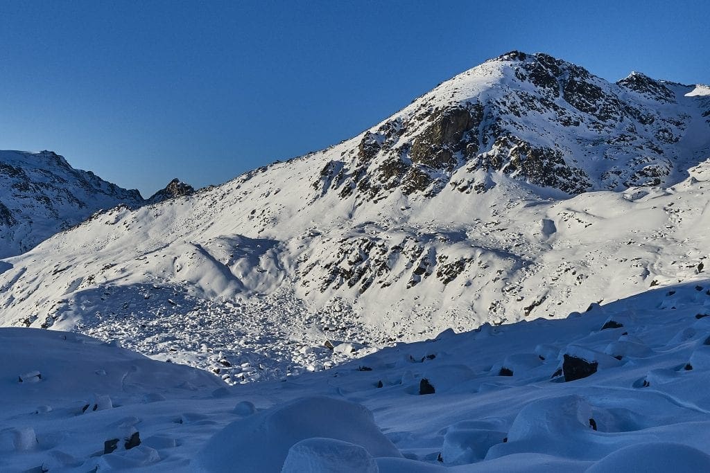
Above: Thin coverage in many areas, rocks exposed.
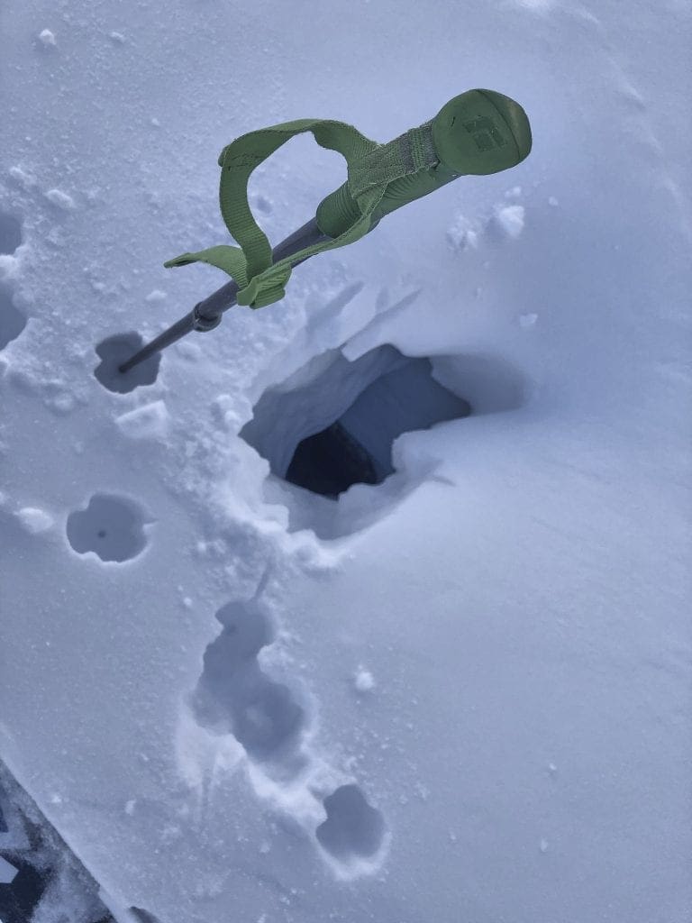
Above: Deep holes and moats in the boulder fields.
This week’s weather at 3550′:
Temps averaged 29ºF, with a low of 18ºF and a high of 34ºF.
No new snow.
Overnight at 3550′:
Temps averaged 20°F.
No new snow.
This week’s weather at 4500′:
Temps averaged 27ºF, with a low of 21ºF and a high of 32ºF.
Winds averaged ESE 6 mph, max 21 mph . Gusts averaged ESE 11 mph, max gust ESE 43 mph.
Overnight at 4500′:
Temps averaged 19ºF overnight, with a Low of 17ºF.
Winds averaged SSW 2 mph overnight. Max gust W 9 mph.
NWS Rec Forecast HERE
State Parks Snow Report and Motorized Access information HERE
TREND
Generally cool temperatures forecasted this weekend with high pressure. It’s 6ºF at the Palmer airport this morning and 18ºF on top of Marmot Mountain at 4500′. An inversion today has produced warmer temperatures at the upper elevations. Light winds through the weekend. No new precipitation forecasted.
The avalanche hazard is expected to remain the same through the weekend.


