
Hatcher Pass
|
|
This information is a Conditions Update. Danger ratings are only issued with avalanches advisories. The next avalanche advisory is scheduled for Saturday January 26, 2019.
Previous avalanche advisories HERE
MIDWEEK SNOW AND AVALANCHE CONDITIONS SUMMARY
Triggering a slab avalanche is unlikely at this time, but it is not impossible. Small avalanches are possible in isolated or extreme terrain. It is still important to be cautious of terrain traps such as cliffs, rocks, and gullies, where even a small avalanche in an isolated location could have higher consequences.
Hatcher Pass has had mild temperatures and overcast skies. A major pattern shift for Southcentral Alaska weather began on Tuesday, bringing traces of precipitation, strong southeast winds, and warming temperatures to Hatcher Pass.
The weather forecast shows that warm temperatures and strong wind will continue through at least the weekend. There is also the possibility for Hatcher Pass to receive precipitation. Remember that poor snowpack structure still exists, and a rapid load could re-activate weak layers. Avalanche danger will rise relative to loading amounts, especially if new snow comes with wind, or worse, if Hatcher Pass gets rain. More snow + more wind = more avalanche danger. Stay tuned to the weather using the links below.
Surface conditions currently range from bare ground on windward ridgeline features, to breakable wind crust, to 2-10″ thick slick, supportable wind slab. Any new snow will hide rocks and hazards. Pockets of good skiing and riding conditions can still be found in protected areas, but are getting harder and harder to find.
This report is a mid-week conditions update, so please be sure to check hpavalanche.org for advisories on Saturdays and follow the HPAC Facebook for updates. Help us keep tabs on the Hatcher Pass area! If you see any avalanche activity send us an observation HERE. Thank you to everyone who has already submitted observations this season – you can see those HERE!
The west side of Hatcher Pass has a thin snowpack and is heavily wind affected. Few areas have enough snow to confidently ride off trail without risking damage to your snowmachine.
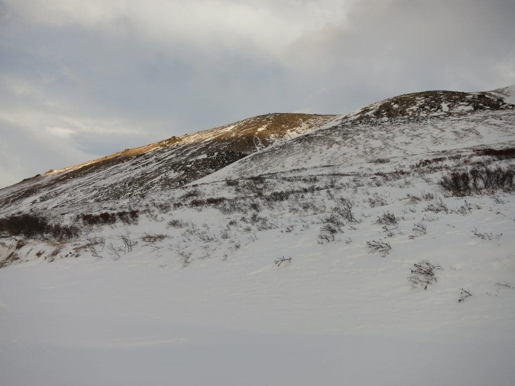
South aspects, such as the ridge shown here near Lucky Shot Mine, are stripped to bare ground in many places. New snow will hide rocks and hazards.
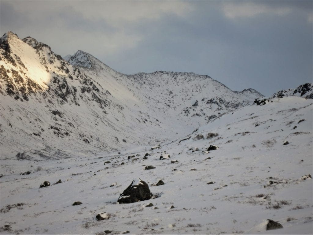
Looking north from Lucky Shot Mine towards Dogsled Pass. At this elevation the snowpack is very thin, evident from the vegetation.
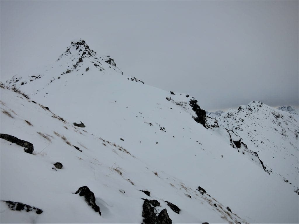
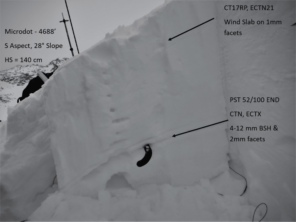
Ridgeline on Microdot. Snow depths are extremely variable at upper elevations. Here vegetation is exposed, but less than 100 yards away, 5-6 feet of snow can be found in cross loaded gullies.

| |
|
|
|
|
|
| Travel Advice | Generally safe avalanche conditions. Watch for unstable snow on isolated terrain features. | Heightened avalanche conditions on specific terrain features. Evaluate snow and terrain carefully; identify features of concern. | Dangerous avalanche conditions. Careful snowpack evaluation, cautious route-finding, and conservative decision-making essential. | Very dangerous avalanche conditions. Travel in avalanche terrain not recommended. | Extraordinarily dangerous avalanche conditions. Avoid all avalanche terrain. |
| Likelihood of Avalanches | Natural and human-triggered avalanches unlikely. | Natural avalanches unlikely; human-triggered avalanches possible. | Natural avalanches possible; human-triggered avalanches likely. | Natural avalanches likely; human-triggered avalanches very likely. | Natural and human-triggered avalanches certain. |
| Avalanche Size and Distribution | Small avalanches in isolated areas or extreme terrain. | Small avalanches in specific areas; or large avalanches in isolated areas. | Small avalanches in many areas; or large avalanches in specific areas; or very large avalanches in isolated areas. | Large avalanches in many areas; or very large avalanches in specific areas. | Very large avalanches in many areas. |
No new natural or human triggered avalanches have been observed or reported.
Old, persistent weak layers in the snowpack still exist, but are generally unreactive at this time. Triggering a slab avalanche is unlikely, but not impossible.
On leeward aspects along ridgelines and cross loaded features, a hard 2-10″ thick slab has been deposited by last weekend’s winds. This slab can be found sitting on loose, faceted snow. It may be possible to trigger a small avalanche on this layer, especially on steep, unsupported slopes in isolated areas. While triggering an avalanche is unlikely, small avalanches may have the ability to carry or wash you into secondary hazards, such as rocks and cliffs, quickly compounding the hazard.
Let’s continue to remind ourselves of a few simple safety protocols for backcountry travel which can increase our level of safety while in avalanche terrain. Always carry on our persons, and know how to use, a beacon, shovel and probe, avoid terrain traps, ski and ride one at a time, and spot our partners.
Old, weak layers in our snowpack are unreactive right now, but could be reactivated with a new load. If the pattern shift in the weather brings snow to Hatcher Pass, avalanche danger will rise relative to new snowfall amounts.
Weather at 3450′ since Saturday 1/19:
Temperatures averaged 22°F, with a low of 11°F and a high of 34°F.
There has been a trace of new precipitation.
Weather at 4500′ since Saturday 1/19:
Temperatures averaged 19°F, with a low of 9°F and a high of 27°F.
Winds averaged SE 7 mph, max 20 mph. Gusts averaged SE 13 mph, max gust 40 mph.
Forecast Weather
Stay tuned to the NOAA point forecast for an updated weather forecast each day. The best way to see if it’s snowing in Hatcher Pass is to look at the webcam snow stake HERE and the Independence Mine SNOTEL site HERE
State Parks Snow Report and Motorized Access information can be found here.


